Chimney Rock, Colorado
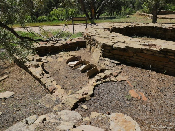
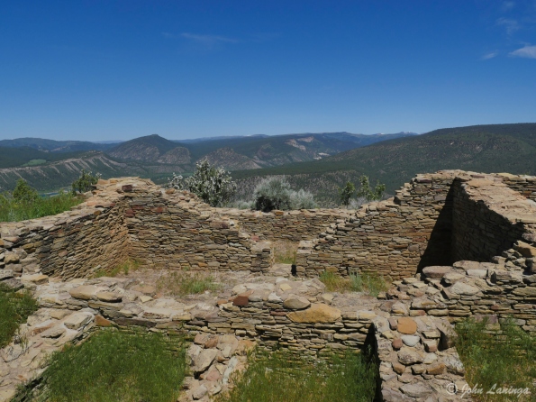
Chimney Rock is an Ancestral Puebloan site, designated on the National Register of Historic Places in 1970. It was a community inhabited between Durango and Pagosa Springs about 1,000 years ago with about 200 rooms. Rooms in the buildings were used for living, work areas and ceremonial purposes.
Housing approximately 2,000 ancient Pueblo Indians between A.D. 925 and 1125, the settlement included a Great House Pueblo with round ceremonial rooms, known as kivas, and 36 ground-floor rooms. A grizzly bear jaw found in one of the rooms when excavated suggested a reverence for the animal, and modern Chaco oral history suggests that the Bear clan originated in the Chimney Rock area.
The construction of the Great House Pueblo at the top of the ridge, close to Chimney Rock and its neighbor Companion Rock, had a large ceremonial role in the later years of Chaco presence. As the moon makes its lunar cycle across the sky over a period of 18.6 years, it appears in a “lunar standstill” between the two rocks for a period of approximately 2 years.
The inhabitants of Chimney Rock abandoned the site in 1125, burning the buildings when they left. Their modern day descendants consider the site sacred with the spirits of their ancestors, and have asked the Forest Service to refrain from further excavation out of respect.
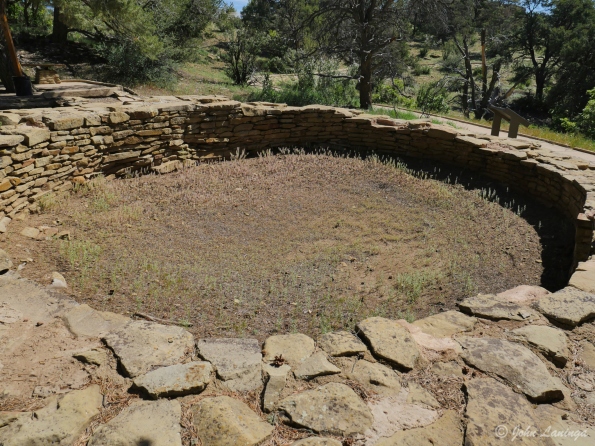
A Kiva in the lower village
Work area (grinding corn) in the lower village
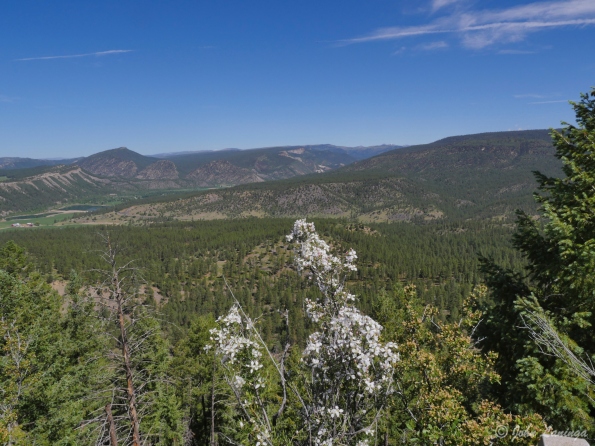
Sure is a magnificent view from up here!
Inside the Pueblo Village walls

It’s a bit of a walk to get to the Great House
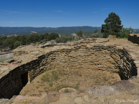
Inside the Great House walls
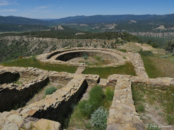
Showing some of the complex structure of the Great House
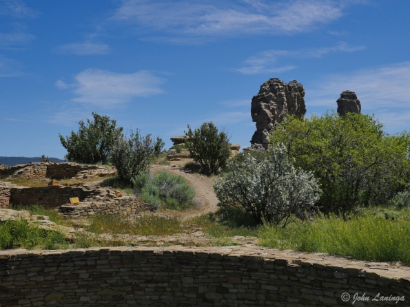
A view of Chimney Rock, viewed from the Great House
Creede, CO & Bachelor’s Loop
Creede, CO at one time was one of the biggest silver mines in the country. Creede was the last silver boom town in Colorado in the 19th century. The town leapt from a population of 600 in 1889 to more than 10,000 people in December 1891. The Commodore mine is now disappearing, but it has 5 different levels spread out over 200 underground miles.
Creede’s boom lasted until 1893, when the Silver Panic hit all of the silver mining towns in Colorado. The price of silver plummeted and most of the silver mines were closed. Creede never became a ghost town, although the boom was over and its population declined. After 1900, Creede stayed alive by relying increasingly on lead and zinc in the ores. Total production through 1966 was 58 million troy ounces (870 metric tons) of silver, 150 thousand ounces (4.7 metric tons) of gold, 112 thousand metric tons of lead, 34 thousand metric tons of zinc, and 2 million metric tons of copper.
During it’s heyday, the Colorado Capital (Denver) enacted major legal reform movement against gambling clubs and saloons. Numerous owners of major gambling houses in Denver relocated to Creede. Among them was the infamous confidence man “Soapy” Smith, soon the uncrowned king of the criminal underworld. Other famous people in Creede were Robert Ford (the man who killed outlaw Jesse James) and Bat Masterson.
After touring the Mining Museum (very well done, by the way), take a drive through Bachelor’s Loop. That is, if you don’t have a fear of heights. Also, best to have a 4 wheel drive vehicle. There are some very steep sections, some very narrow sections, and all gravel. But it is definitely worth the time because the views are just stupendous. And if you have a real 4 wheel drive vehicle you will find miles and miles of old roads and ghost towns.

The drive into Creede shows why it is a mining town

Those were some tough and dangerous jobs!

Working at the face of the mine

Sometimes you had to go down to get ore….
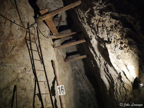
And sometimes you could just follow the vein.
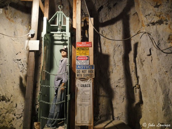
Not a very roomy trip down (or up) to the different levels

The gravel road takes you up to the Commodore mine

One of the main Commodore mine structures
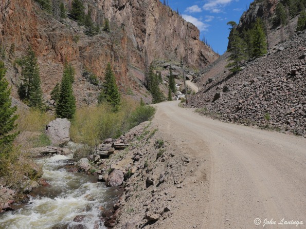
The road is quite rough, steep, and narrow
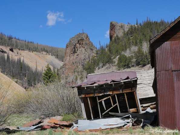
A different mine complex perches on the steep hillside
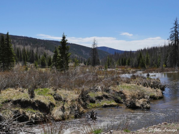
At the top is a peaceful valley with the headwaters of the Rio Grande river

Coming back down to Creede

Said to be the highest church in the USA
Ouray, Silverton, and Million $$ highway
Ouray is an old (1870’s) Colorado mining town turned tourist town. Often called America’s Switzerland, it is located high in the mountains. Although it still has an active mine, most city revenues come from tourists. There are many cute and interesting cafes, restaurants and hotels in town. We’ve sampled a few….
Likewise, Silverton owes its origins to silver mining. And, like Ouray, it exists today mainly due to tourists. This is helped because it is the end of the Durango & Silverton Narrow Gauge Railway, which still uses steam locomotives and old rolling stock. The train ride, starting in Durango, is a magnificent scenic tour of the Colorado high mountains. Silverton’s entire downtown is registered as a National Historic Landmark.
To get from Silverton to Ouray, you have to take the “Million Dollar Highway”, so named because legend has it that cost a million dollars per mile to build. Another legend says that over a million dollars of gold is in the fill dirt used to construct it. In any case, better not be afraid of heights, because the road is narrow,with steep dropoffs, and many sharp curves, But it is a beautiful drive.

To get to Silverton, you have to cross several passes

A view descending into Silverton

Downtown Silverton

Yep, curvy road and big dropoffs!

Downtown Ouray

Hotel in Ouray

Water fall from way up high

Mountains surrounding Ouray
Great Sand Dunes, Colorado
Today our adventure took us to the Great Sand Dunes, about 25 miles from where we are parked in Alamosa, Colorado. It was quite a spectacular trip, seeing all this sand in the middle of the valley, and surrounded by mountains. We had a nice hike, climbing high in the hills to get a spectacular views of the dunes.
The dunes were formed from sand and soil deposits of the Rio Grande and its tributaries, flowing through the San Luis Valley. Over the ages, glaciers feeding the river and the vast lake that existed upon the valley melted, and the waters evaporated. Westerly winds picked up sand particles from the lake and river flood plain. As the wind lost power before crossing the Sangre de Cristo Range, the sand was deposited on the east edge of the valley. This process continues, and the dunes are slowly growing. The wind changes the shape of the dunes daily.

One of the many 14,000 ft high mountains along the way.

A view of the dunes with some of the mountains

Here you can see one of the rivers that feed the dunes

A little posing along the way

Looking back from the top of the Lookout hike

Many people cross the river to hike in the dunes
Murals of Conejos County
Deep in the heart of the San Luis Valley, you can find a impressive set of murals. These murals, painted on structures on public as well as private land, reflect the history of this area. Most of these were by Fred Haberlein, known locally as “Lightning Heart”. He is one of the most prolific mural painters in the country. To see these murals, you will have to drive almost 100 miles through very rural USA. Some roads are even dirt, but the trip is worth it.
Below are a few of the highlights.

“Shepherd’s Sunrise”, La Jara

“Whooping Cranes”, Romeo, CO


“The old Plaza at Conejos”, Conejos, CO (Inside post office)

“Walking in Beauty”, Antonito, CO

OK, just had to throw in this fire plug

“The Great Water Serpent”, Antonito, CO

“Mimbres Rabbit”, Antonito, CO

“The History of San Luis Valley”, Antonito

“The History of the Conejos Region”, Antonito, CO

“Bronco Busters”, Manassa, CO

“The Rams”, La Jara, CO

Unknown, in Alamosa, CO
A quick hike
Colorado Springs is a neat city in a great location. Today we did a quick hike, on a trail system starting in the city limits. The recent rains has made for a lot of mud, but we had a nice hike anyway. Not shown in the pictures is the wonderful view of Pikes Peak, which today unfortunately was somewhat hidden by the clouds.


Royal Gorge, Colorado
The Royal Gorge (also Grand Canyon of the Arkansas) is a canyon on the Arkansas River near Cañon City, Colorado. With a width of 50 feet (15 m) at its base and a few hundred feet at its top, and a depth of 1,250 feet (380 m) in places, the 10-mile-long canyon is a narrow, steep gorge through the granite of Fremont Peak. It is one of the deepest canyons in Colorado.
In the early 1900’s, Canon City wanted a different water source and built an 8 mile long water pipeline. It was made from California redwood, and was used until the 1970’s. The wood is still in such good shape that it has been declared a Historical Site to prevent people form taking it all.
This stretch of the Arkansas River is one of the busiest white water rafting areas in the country. Couple that with many zip lines, some across the canyon and some connecting different areas, this is a very popular tourist attraction. There are many ways to visit and see this scenic wonder— from a train in the canyon bottom, on a bridge (or gondola) at the top, or hiking along the rim. The weather cooperated just enough so we could do all three. And, if you are brave, you can take a zip line across the top of the gorge (no, we didn’t).
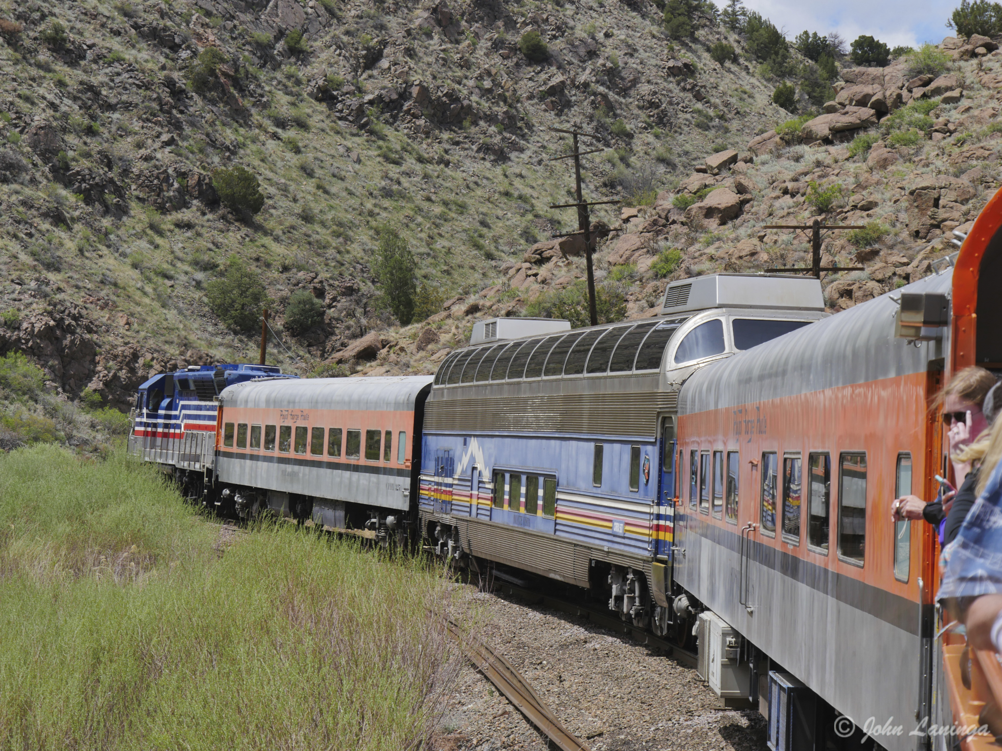
The train heads into the Gorge, starting in Canon City
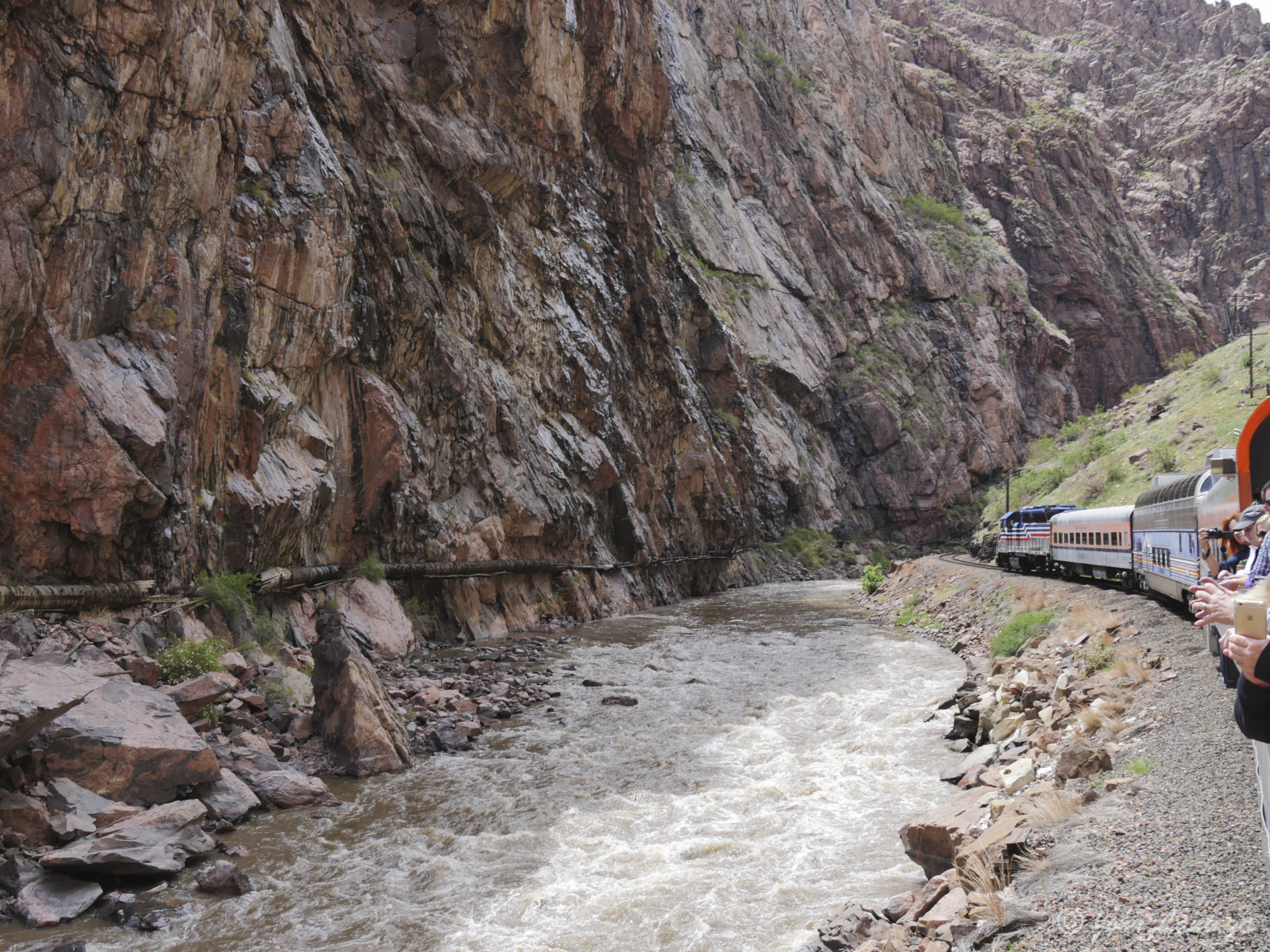
On the train, heading into the narrow part of the Gorge (note water pipe on left)
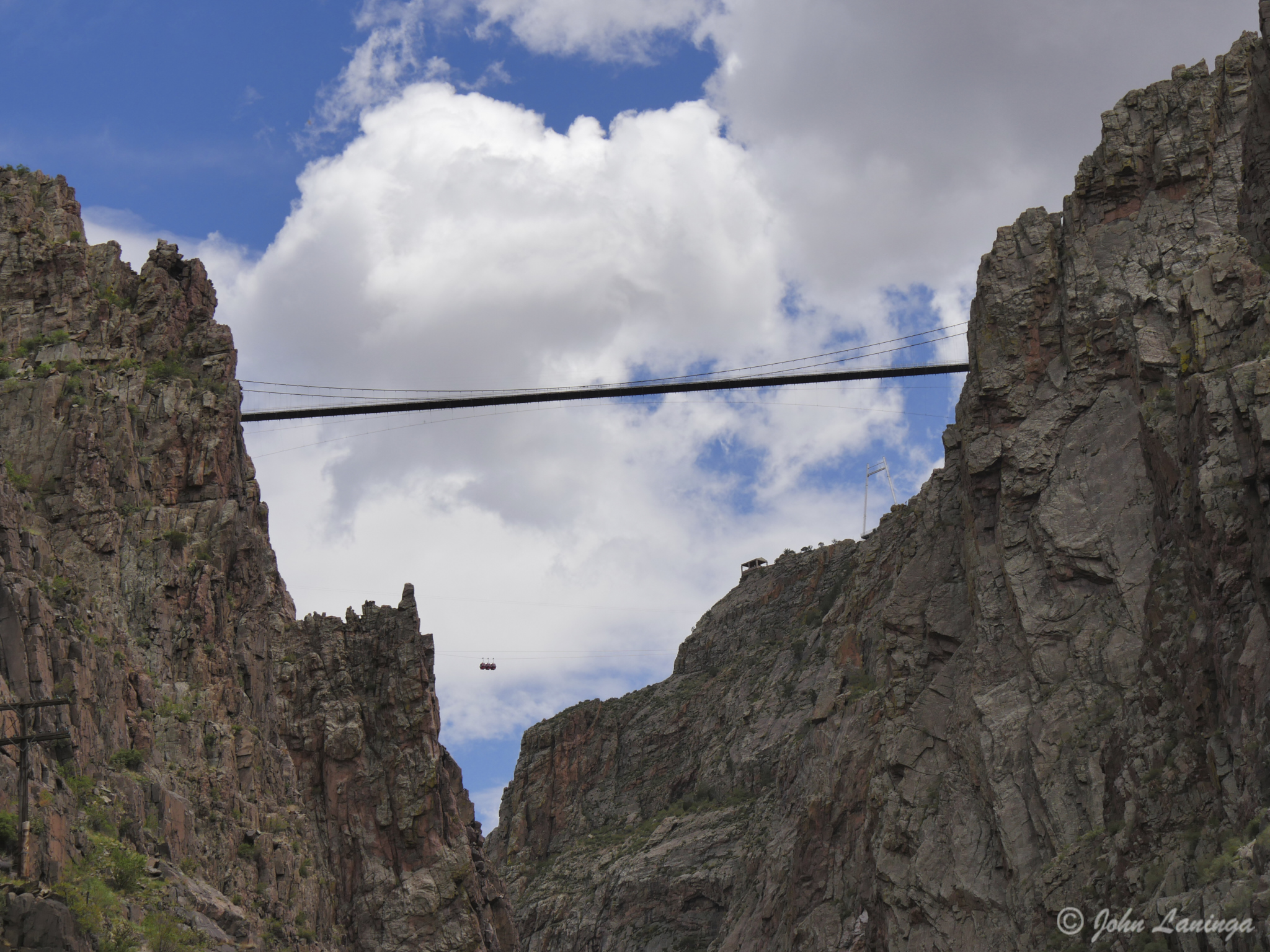
Looking up, at the Bridge (can you see the gondolas?)
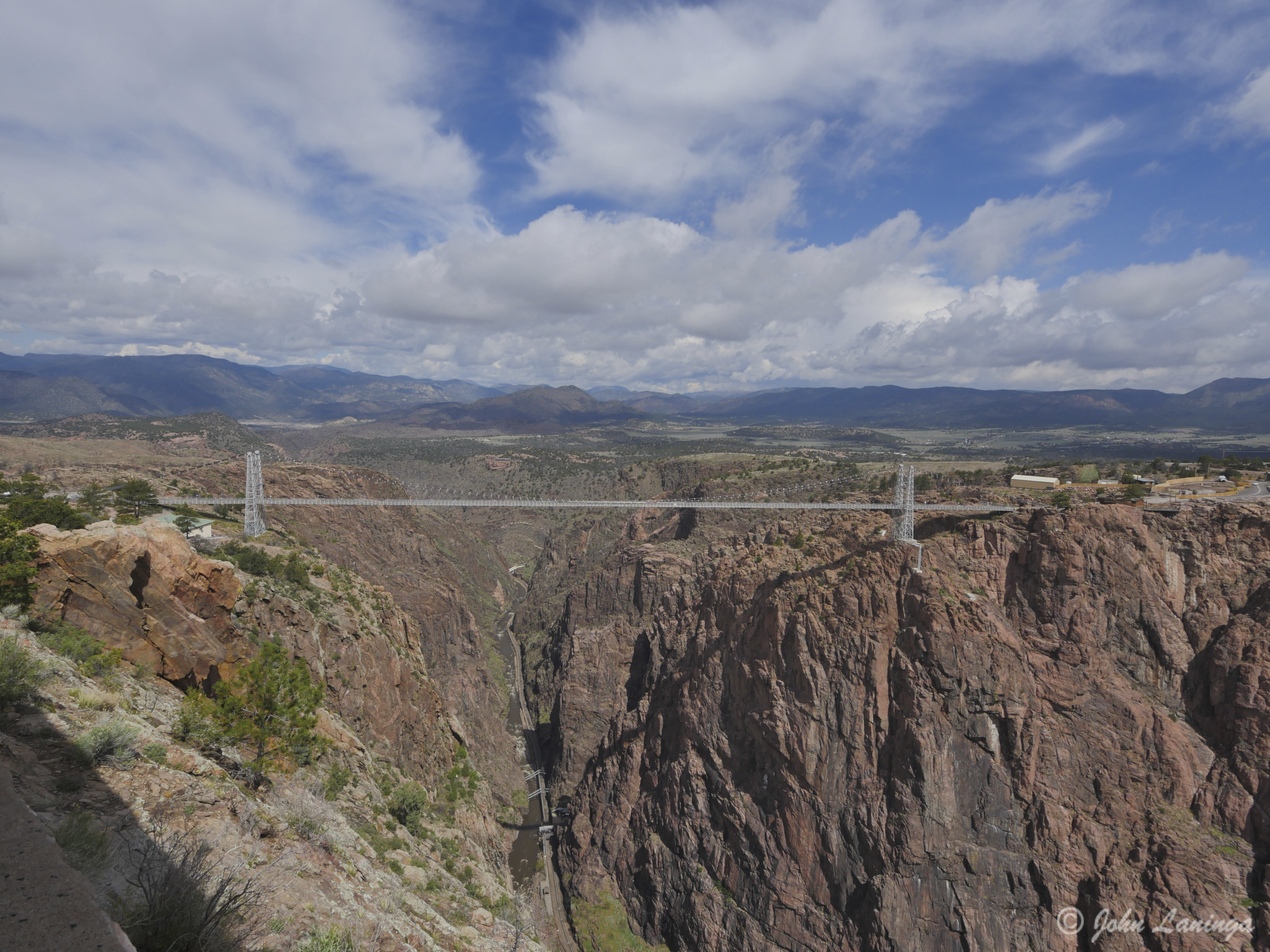
A wide angle view of the bridge
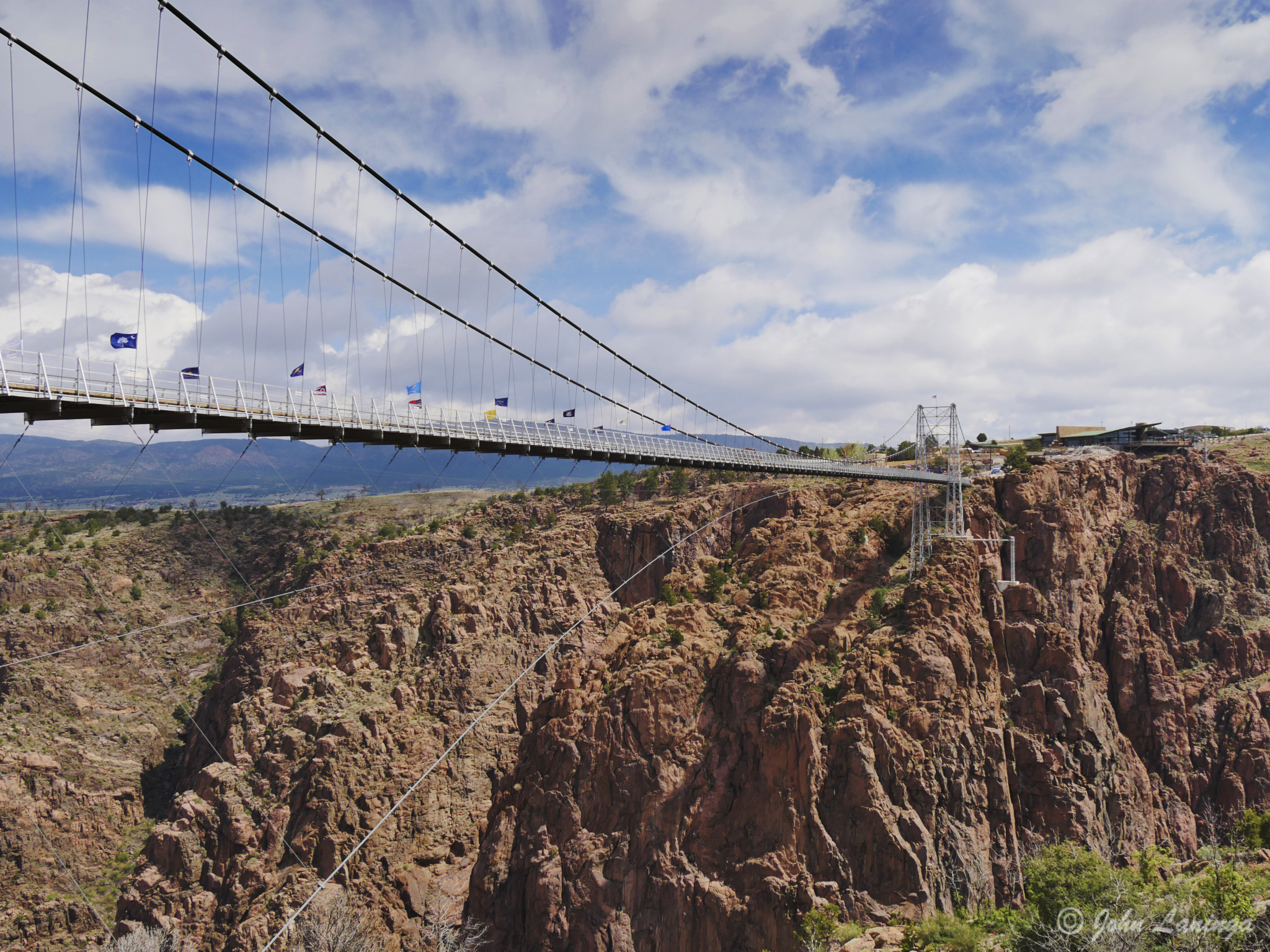
The bridge, viewed from the south end
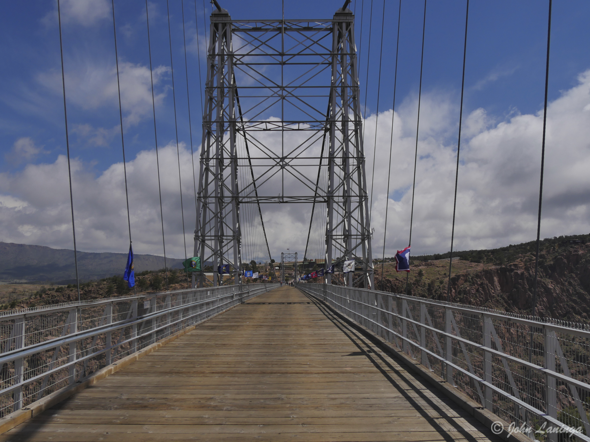
Looking down the bridge itself
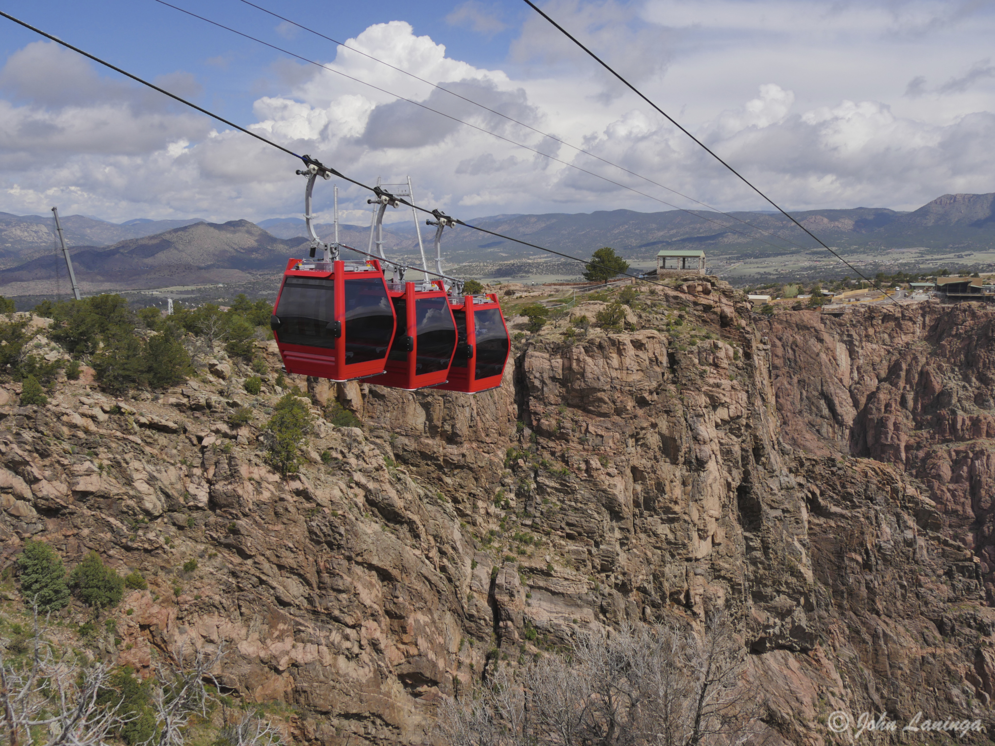
Closeup of the gondolas
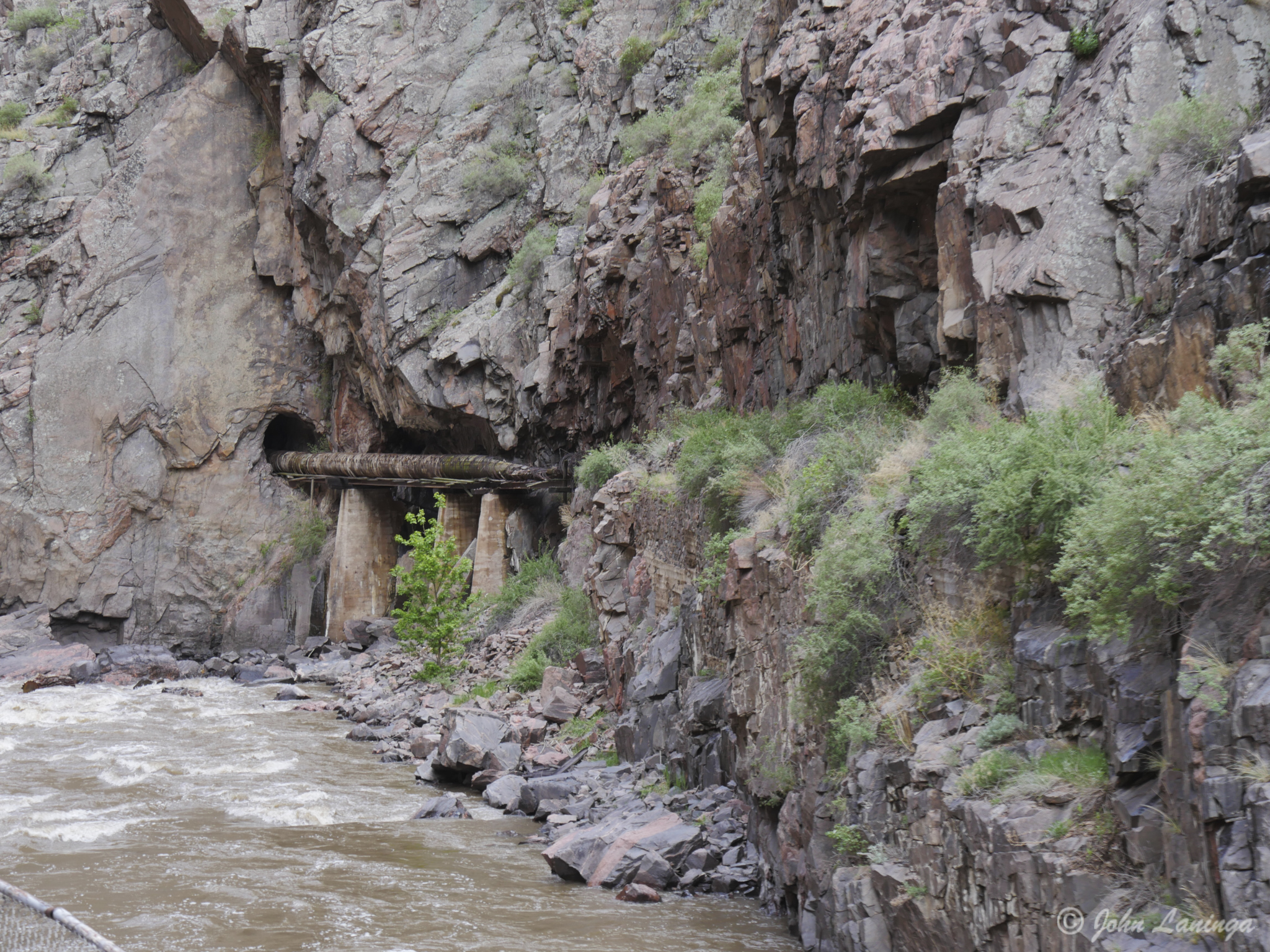
Another part of the wooden water pipe. All the tunnels were hand dug!
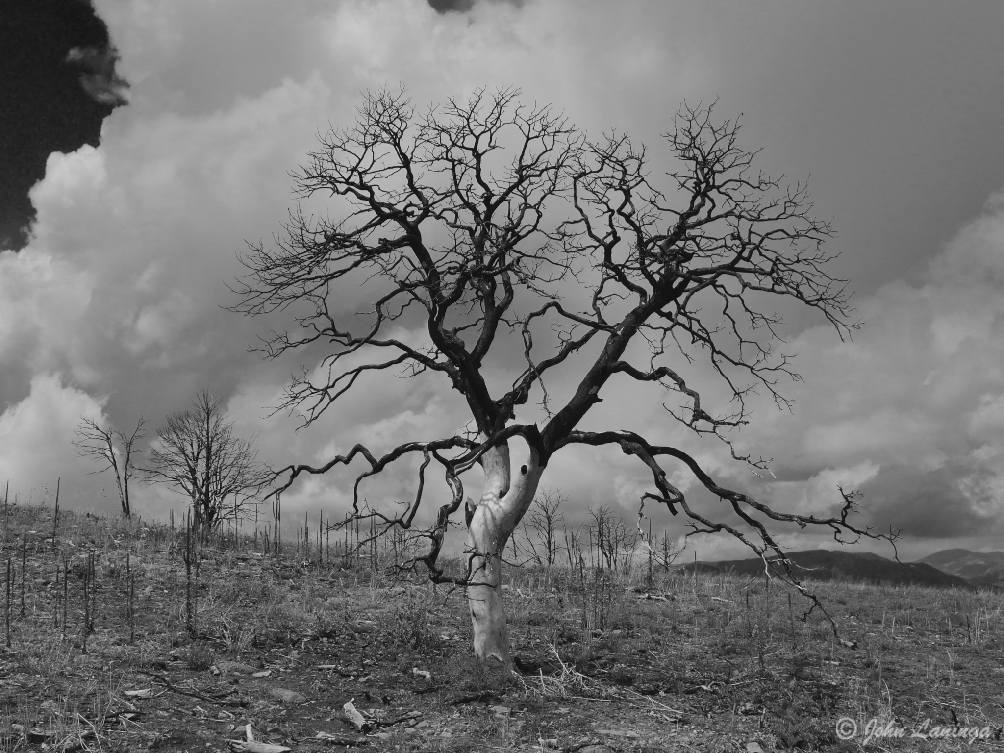
A black and white “art shot” of a tree burnt during the fire of 2013
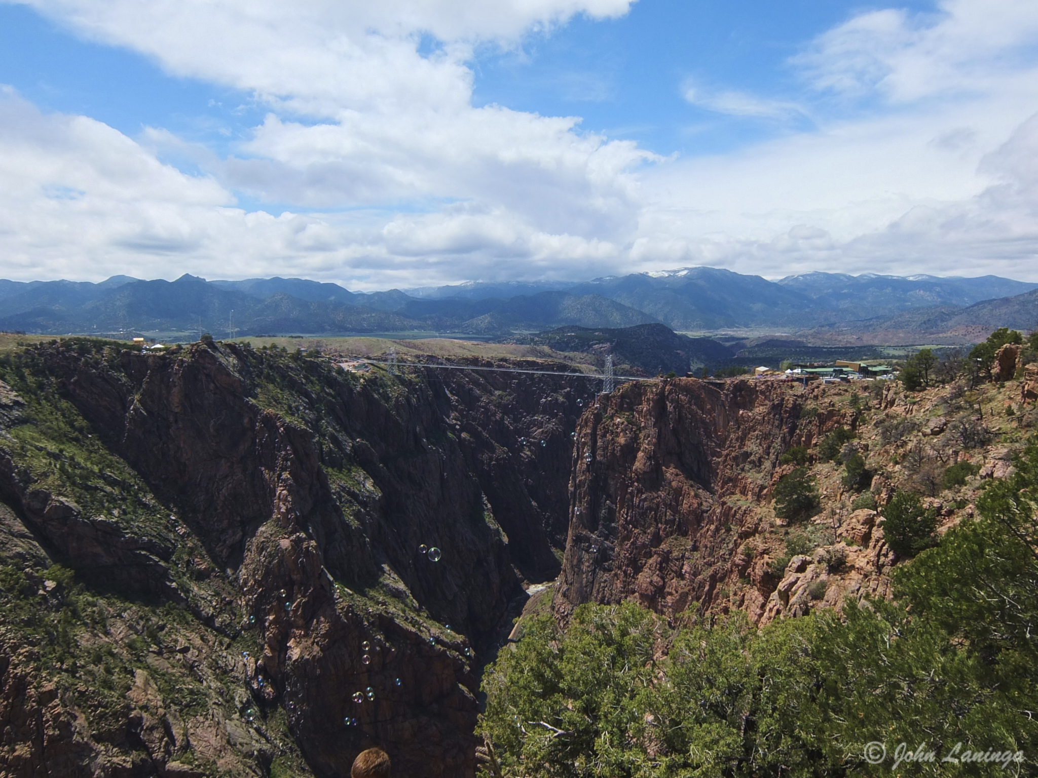
A view of the bridge from the rim hike
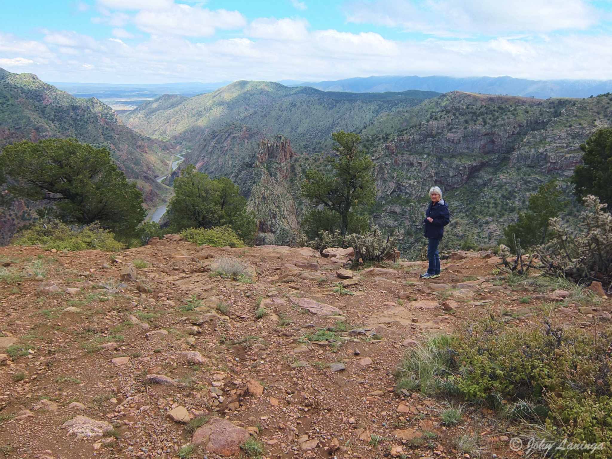
Romola standing at the rim of the Canyon
The Winery at Holy Cross Abby
If you ever go through Canon City, CO make sure to stop for a wine tasting at the Winery at Holy Cross Abby. This abby, built in 1924, was used by Benedictine Monks and the Roman Catholic Church. It was used primarily as a boys school, but closed in 1982 because of declining enrollment. It continued to function as a monastery until 2005, and eventually wound down and was sold in 2007 to an investment firm.
Today, it is a popular event center, used for weddings, receptions, meetings, and so on. The Benedictine monks had planted grapes and established a wine making capability. This continues to this day as one of Colorado’s favorite wineries. And why not? They have a large variety of wines, ranging from sweet one to full body wines. And, they were really excellent and even better, complimentary (except for the two special reserves, which were $1 each).
So we lugged a half case of wines home, including a special gift of a sweet wine (for Ida Cook) and a very special full bodied Red for daughter Tanya Allen. At least, if we can keep our hands off them till we get home….

Front of the 4 story abby

A view of the abby

An old truck in the vineyard

Vines, ready to grow!

This table once was a square grand piano!

Original couch used by the Abbot for receiving dignitaries

Inside the sanctuary, being prepared for a wedding

Pouring one of the red wines

What it’s all about… wine!

It is almost mother’s day, right?
Salida, Colorado
We are parked in the 4 Seasons RV Park in Salida, Colorado. We are here for a rally with our friends of the Pikes Peak Rollers. It’s nice to catch up with old friends, enjoy some good food, and appreciate the local scenery.
Founded in 1880, Salida was originally a railroad town and was a significant link in the Denver and Rio Grande Western Railroad. After World War II the railroad began pulling back its operations in Salida. Many residents in the 1950s, 1960s, and 1970s worked either in local ranching operations or commuted north to Leadville to work at the Climax Molybdenum Company. Today, the most prominent business in Salida is tourism, consisting of skiing at Monarch Ski Area, whitewater rafting, kayaking and outfitting, particularly on the Arkansas River. In addition, fishing in the Arkansas River is a big attraction.

On US-50, heading into Salida

A nearby mountain peak

An interesting house

Another stylish home

Not sure what this style is– Cape Code?

The Arkansas River runs right through town

A ranch, across from the RV Park

Fly fishermen in the Arkansas
Austin, Texas
A group of RV travel friends, members of the Traveling Supremes and friends, met and stayed in San Marcos, TX to visit the area. We had a fun time together, visited the many historical sites of the area, and of course sampled the local cuisine… barbecue!
Our first visit was to the LBJ library, where we had a chance to revisit the history of the LBJ presidency. This was followed by a visit to the Bullock Texas State History Museum, where we learned more about Texas and its founding. I highly recommend this to anyone, not just Texans… very interesting! That evening, Dave Phillips brought in the “Fajita King”, who made some excellent Fajitas from scratch.
Our next visit was to the San Marcos Springs, a natural spring site located on (or near) Texas State University. There we visited the aquarium and took a glass bottom boat tour to see the bottom of the lake and the springs themselves. A pot luck meal completed another satisfying day.
Then, another trip took us to the Texas State Capital building, where a guided tour introduced us to the largest state capital building in the US. The history of this marble building was a story all to itself. Most interesting! After this we visited the University of Texas, and went to the top of the Clock Tower, notorious for being one of first public mass murders in recent history.
A final meal at the Grist Mill in Gruene helped end a most interesting visit. Thanks to the Phillips and Hoovers for putting together a fun gathering!

The group at the LBJ Museum

Les, Ida, LBJ and Romola

The “Fajita King”!

View of the Texas Capital

Showing when the Capital was built

Looking down on the Rotunda floor

Looking up inside the Rotunda dome

State legislature

Down the east hallway

A view of the clock tower
