Archive
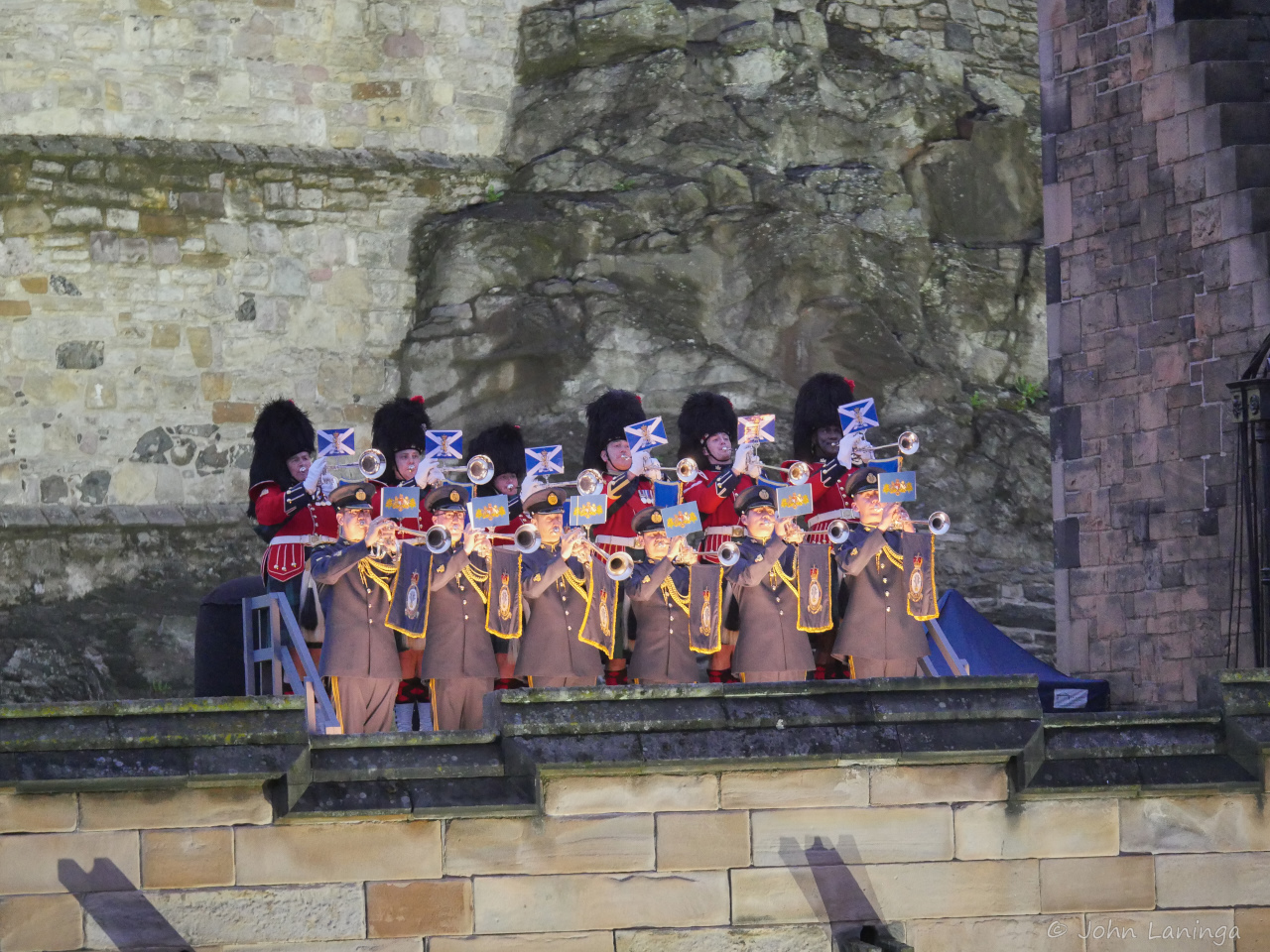
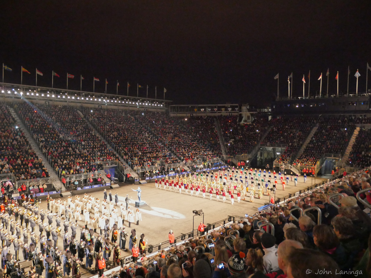
Edinburgh Tattoo, 2015
Since 1950, Edinburgh has a Festival in August. Thousands of people jam the streets, pubs and restaurants. There are all kinds of vendors and street entertainers, all hoping to strike it big (some do). Certainly one big party!
But the highlights of the Festival is the nightly Tattoo. Drawing on a world wide source, there are marching bands and precision dancers from around the world. In fact, the Tattoo emphasizes the International aspects, as a means of drawing people together. A list of the performing bands:
The Royal Scots Dragoon Guards
The Black Watch, 3rd Battalion The Royal Regiment of Scotland
The Highlanders, 4th Battalion The Royal Regiment of Scotland
1st & 2nd Battalions The Gurkha Rifles
The Royal Air Force Pipe Band Association
The Citadel
The Royal Canadian Mounted Police
Auckland Police
Manly Warringah
Christchurch City
Scotch College
The Crossed Swords
The Pipers’ Trail
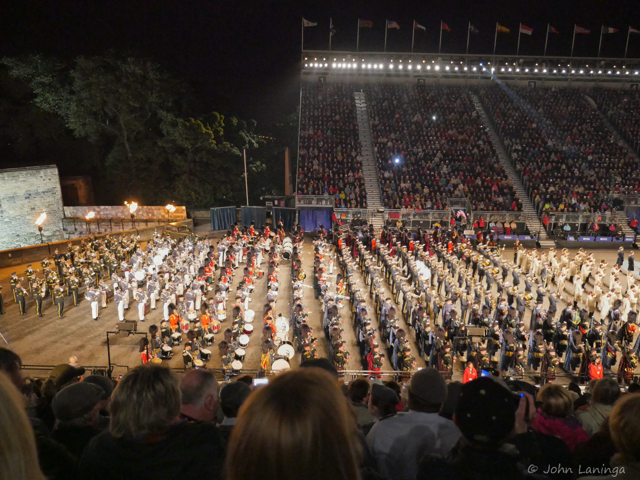
Our friends Bob and Margaret got some spectacular seats, high up at the entrance. Here we could see the acts come marching from inside the castle to the performance area. Coupled with an amazing light show, \it was a visual and auditory delight. If you can make it, it certainly is worth while(but buy tickets early, it sells out fast!).
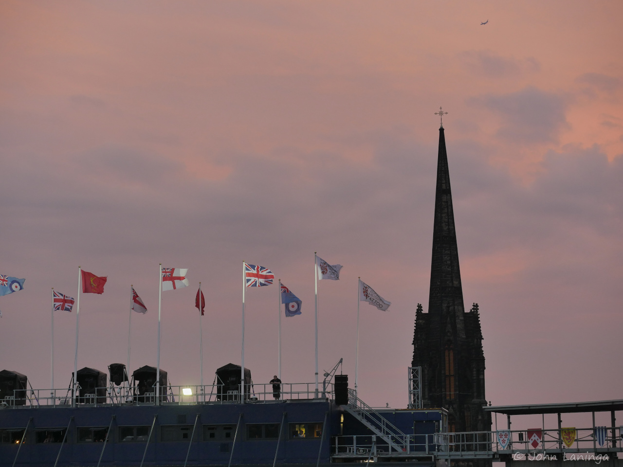
A colorful sunset to start the festivities
Opening ceremony
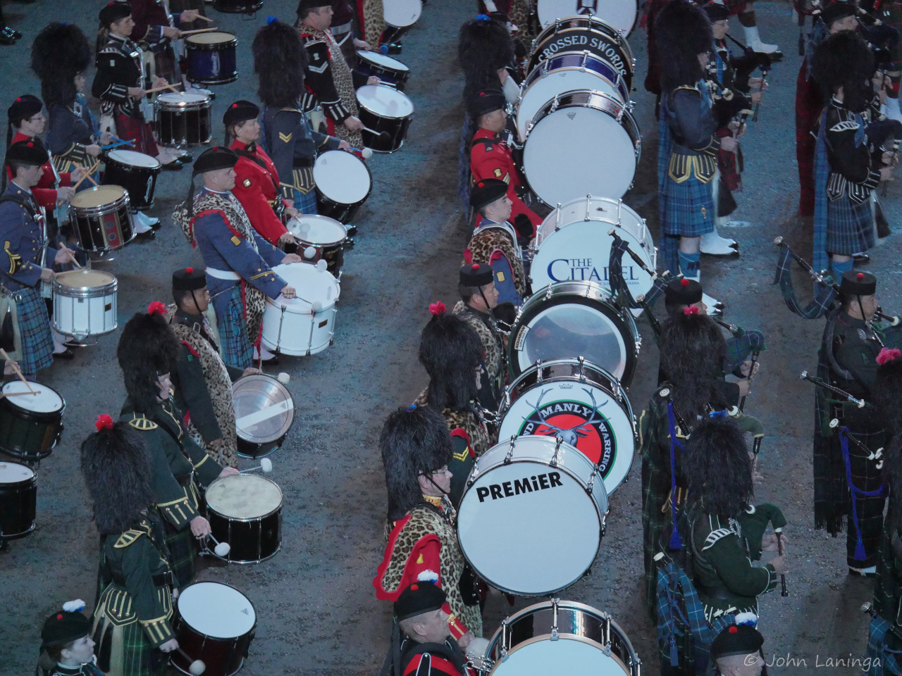
Massed bands
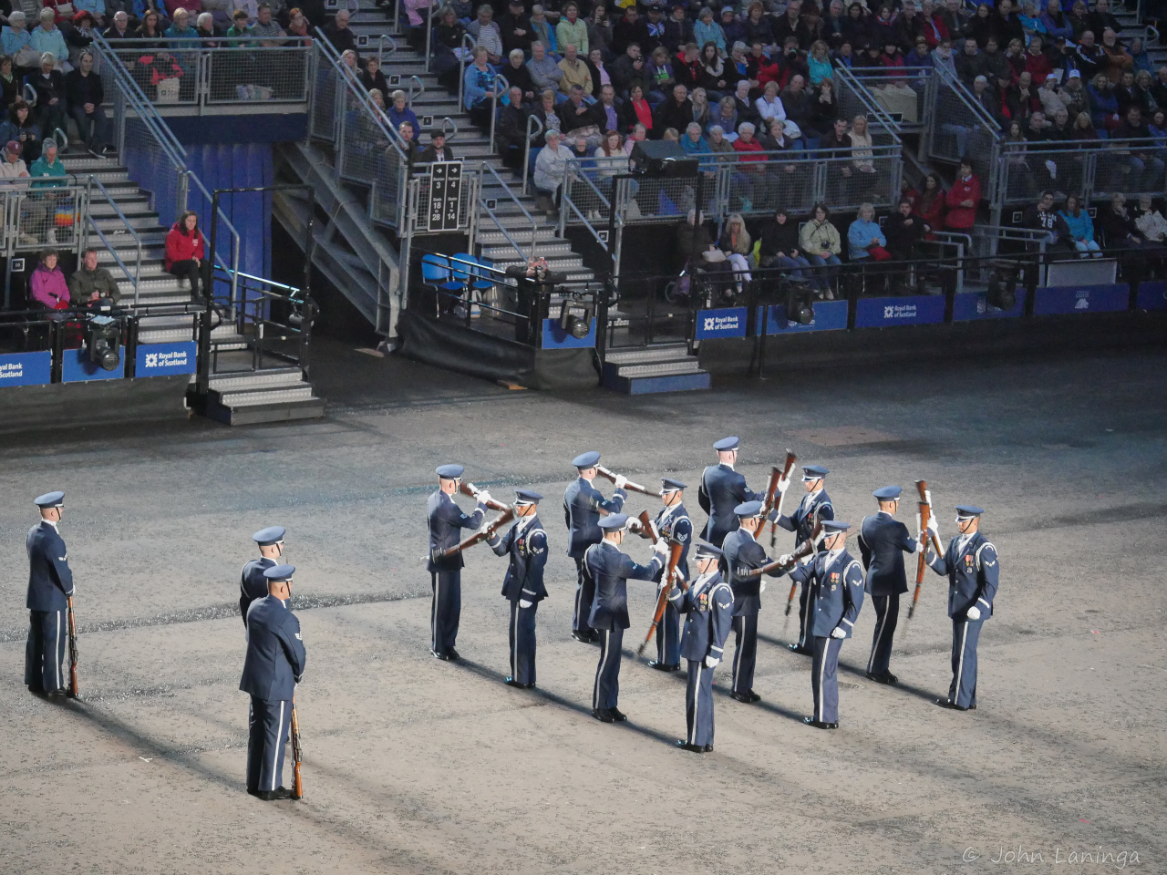
US Air Force Honor Guard
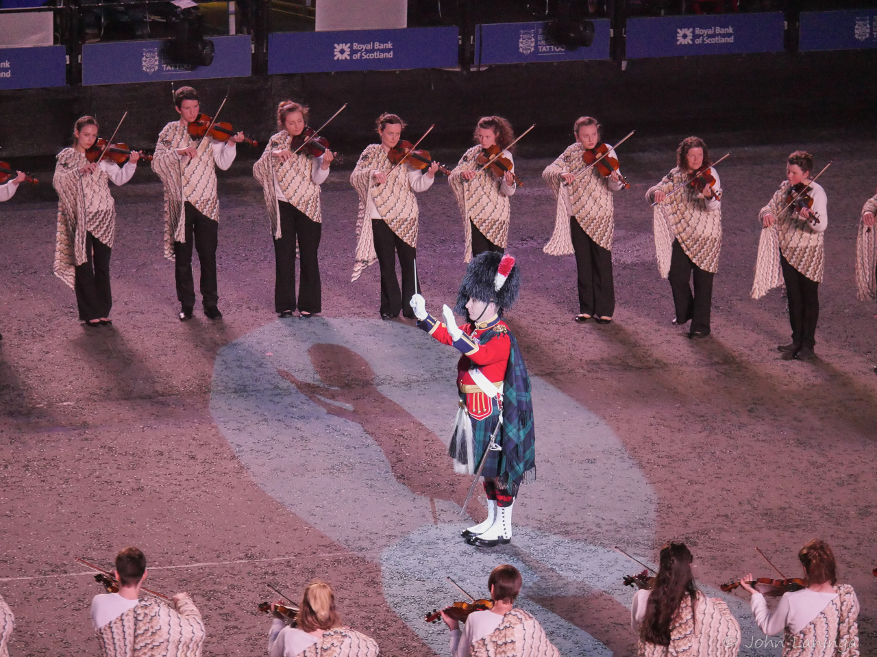
Conducting the Shetland Fiddlers
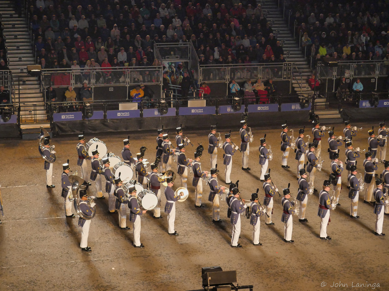
The Citadel represents the USA
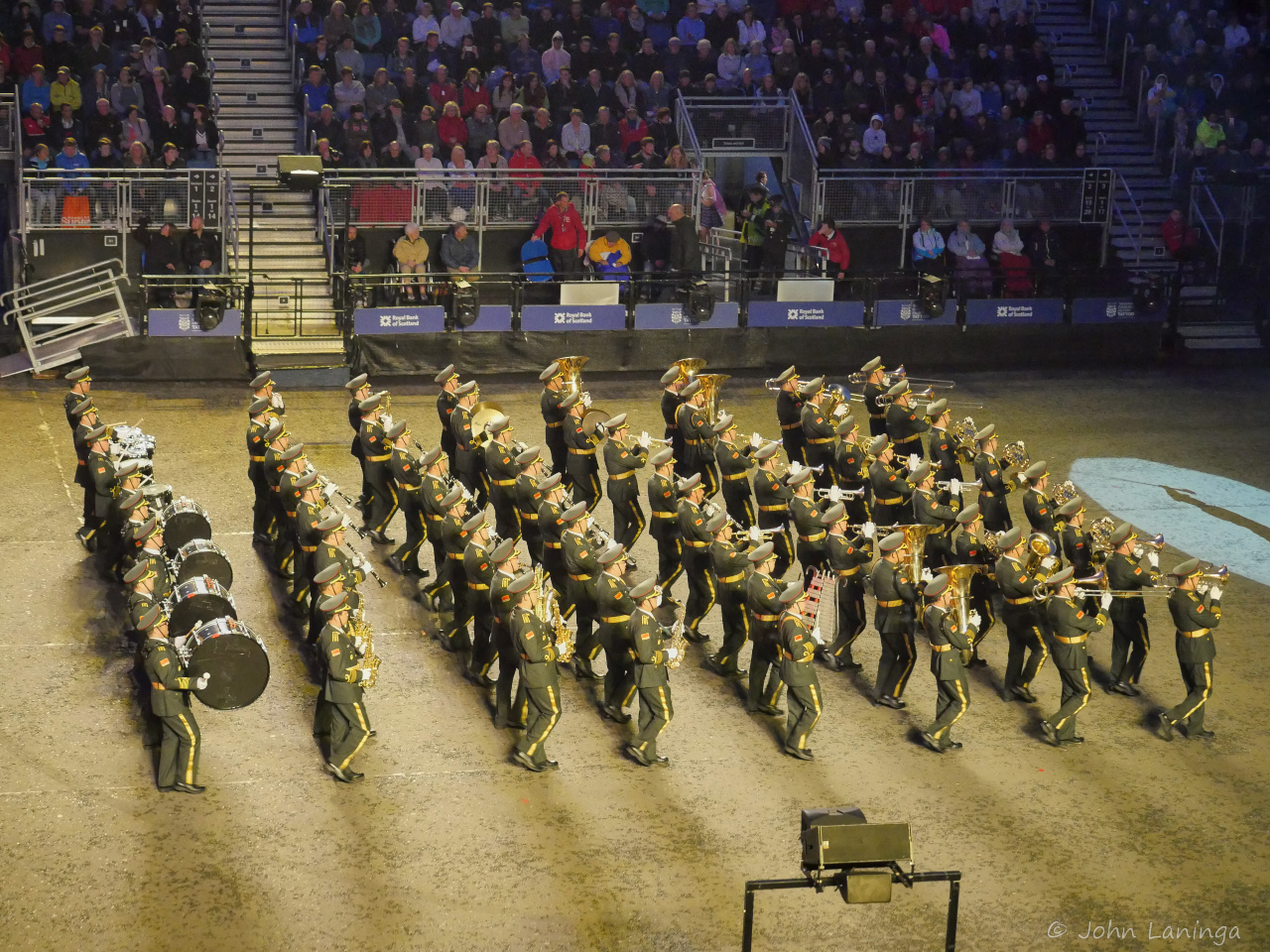
Chinese Liberation Army Marching Band
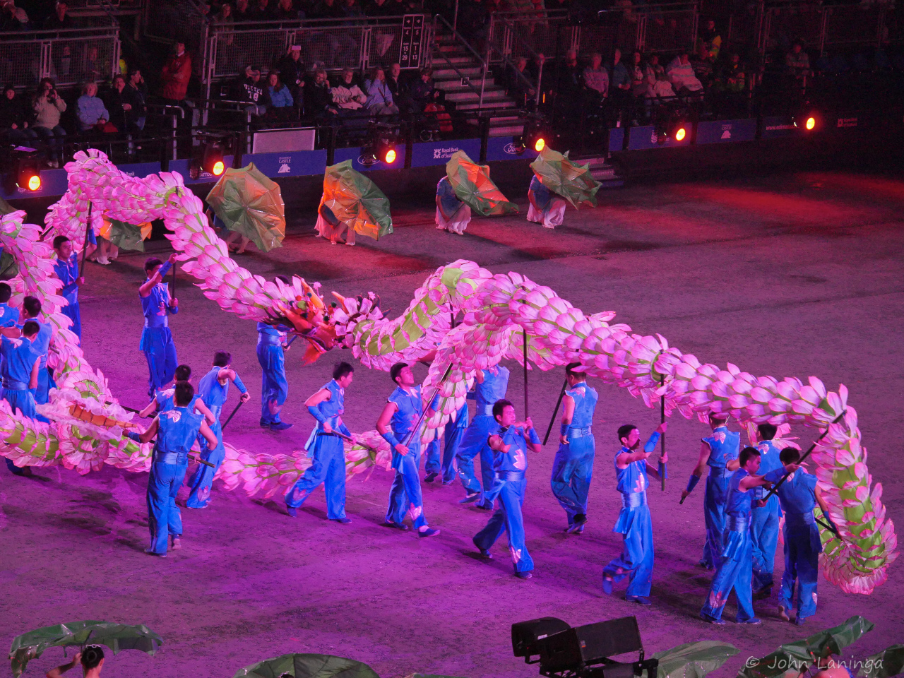
Chinese dragon festival
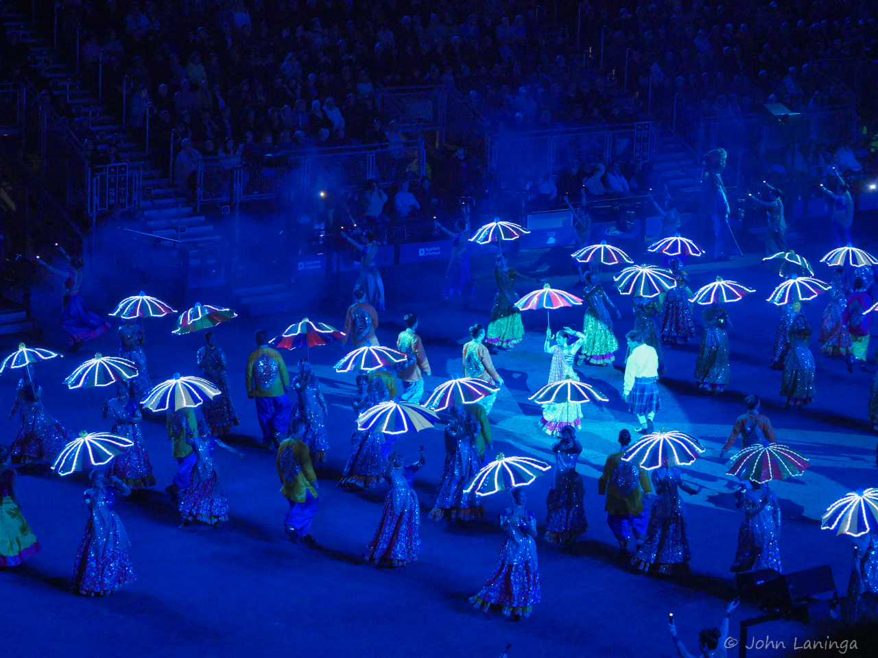
Indian dancers with light display
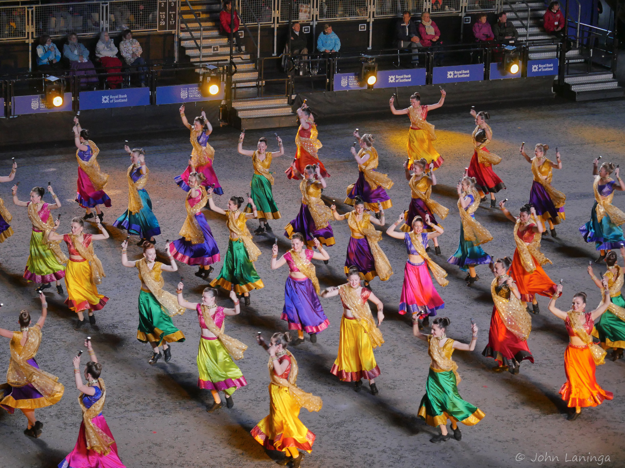
Bollywood dancers
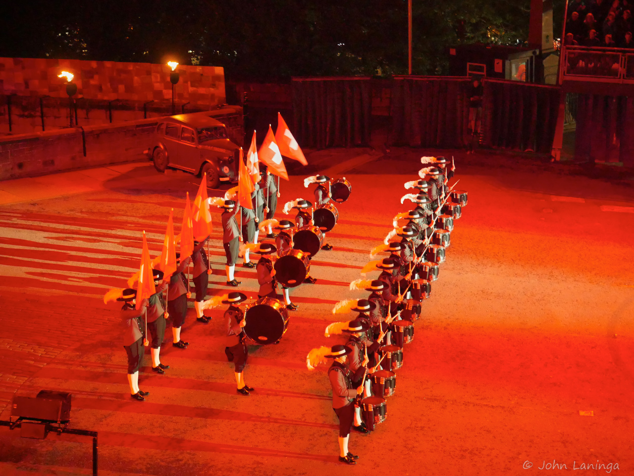
Switzerland’s Top Secret Drum Corps
Left side of the finale
Right side of the finale
London, 2015
After our cruise, we spent 4 days in London. We walked, a lot. On the day we arrived, we went to the Embankment and strolled over the bridges. Great views all around. In the evening we had a nice dinner in Devonshire Arms pub, which dats back to 1852, where we had some really fine food — and local beers.
On Wednesday we had a tour of the Royal Garden Gallery, some really fine old masterpieces showing gardens of old. Then we toured the State Rooms. Quite amazing to see the same rooms and settings as we see on the news during state visits! After dinner (Da Mario’s, a family owned Italian restaurant), we took off again to the Parliament buildings and Big Ben. Tried to take some nice shots, but it was rainy so picture opportunities were limited.
Thursday started with a walk to Kensington Palace, current home of William and Kate (no, they weren’t there). Then a walk through Kensington Park to Harrods, looking at some seriously expensive items. Later in the afternoon took the Tube to St. Katharines dock, a complete boat dock right inside the city of London. Some more Tower pictures, and we went back to the Embankment and crossed to the South Side, found a rather unique new restaurant called “La Paine” before heading home and starting to pack.
All in all, we lucked out with the weather, only had a short drizzle to damped our walking.

Kensington Palace

Entry into Kensington Palace

Gardens at Kensington Palace

Prince Albert Monument

Detail word at Prince Albert Monument

Fancy railing (Prince Albert Monumentl)

Harrods

Seafood at Harrads

Pub inside St. Katharines Docks

City Hall and the Shard

Tower Bridge

Tower of London

Parliament and Big Ben

The Eye

Queen Victoria
Reykjavik
Reykjavik is considered to be a good place for nightlife. A visit to old town shows why, lots of bars, restaurants, and entertainment venues.
On our first evening we took a “Haunted City” walking tour. Although a bit short on ghosts, we did hear some great folklore and visited many of the city’s historical sites, including the old cemetery. After all, 90% of Icelanders have some belief in elves or trolls….
The next day we walked through town, did some window shopping and visited local landmarks. This also included a stroll to the Hallgrimskirkje church, certainly unique. Some hate it, some love it, but it certainly is visible.

A view of old town skyline

City street

Gay pride week

Parliament building

City hall

Church

Inside church, looking at the organ
Iceland
Our next port of call was Reykjavik, Iceland. More about Reykjavik later, there it’s a lot to say about Iceland itself. It has a population of about 350,000, so small by U.S.standards. But an interesting place…
It’s main industry is tourism, followed by fisheries and farming. It is located on the faultline between the European and American plates, so volcanic activity is high. They have harnessed the energy and it supplies the country with heat and electricity. Even the streets in Reykjavik are heated and are snow free in winter.
Our excursion took us to the faultline itself, where we were able to walk from America to Europe! Then we visited some of the thermal plants, the spectacular Gullfoss waterfall, and the Strokkur Geyser. Smaller than Old Faithful, but much more active.
The thermal plant was very interesting. Here, they tap some 2 miles down into a volcano, releasing hot water and steam. The steam is used to generate electricity, and hot water used to heat glacier runoff and pipe it to Reykjavik, some 27 kilometers away. There it is used for heating, as well as hot water for household use. The remaining hot water is used for heating the streets, and eventually to heat the ocean at a beach… allowing swimming in arctic waters.
Iceland is also known for its horses. Originally from Norway, they have been bred for Icelandic conditions. Although they are smaller than say U.S. horses, they are known for endurance. Very seldom will you find them in international competitions, because once a horse had left the country they are not allowed to return.


Faroe Islands
Our destination after Norway was Klaksvik in the Faroe Islands. These islands, and the small town of Klaksvik, are about half way between Norway and Iceland. Although the Faroe Islands is an autonomously governed country, the residents are Danish and defence and justice is handled by Denmark.
The scenery however was dramatic. High cliffs, rolling paired with grazing sheep and more waterfalls than you can count. It was very green and lush. And visible in the bay were huge floating circular nets, which were salmon hatcheries.
The main industry is fishing and lamb. The port city of Klaksvik is small, and not set up for tourism. But we had an excellent hike, about 5 miles up to a viewpoint that was some 1300 feet elevation gain. Gotta work of the calories somehow!

The harbor, with old style barb

A rather unique statue. Never figured out what it represents.

Old style house, Viking ship, and harbor

A view from the top

Hey, we made it up to the top!
A tour of our pad site
For a lot of reasons, we signed up for an annual RV pad site. It is located near Lake Conroe, just north of Houston. Conroe itself has a full complement of stores, restaurants, medical facilities and so on and the Woodlands is just down the road. So we have pretty well everything we could need and want here.
The park itself (Thousand Trails, in Wllis, TX) has undergone some extensive renovations. New sporting areas, new pool area, new docks, and new sites have really given this place a new look. And the hot tub is only a few hundred yards from our site…. So we have a pleasant place to live that is not too far from Dallas (4 hour drive), has all facilities nearby, and close to Houston IAH Airport and cruise ship terminals. And we can safely leave our RV home here when we go on trips, like our upcoming Europe cruise.
Our pad is located in the back, amongst a row of trees so we get some shade. Important during these summer months! So far, we have not done any site improvements, that will happen later. We have a one year lease, and can extend it if we find we like it. Here is a quick tour of some park highlights.
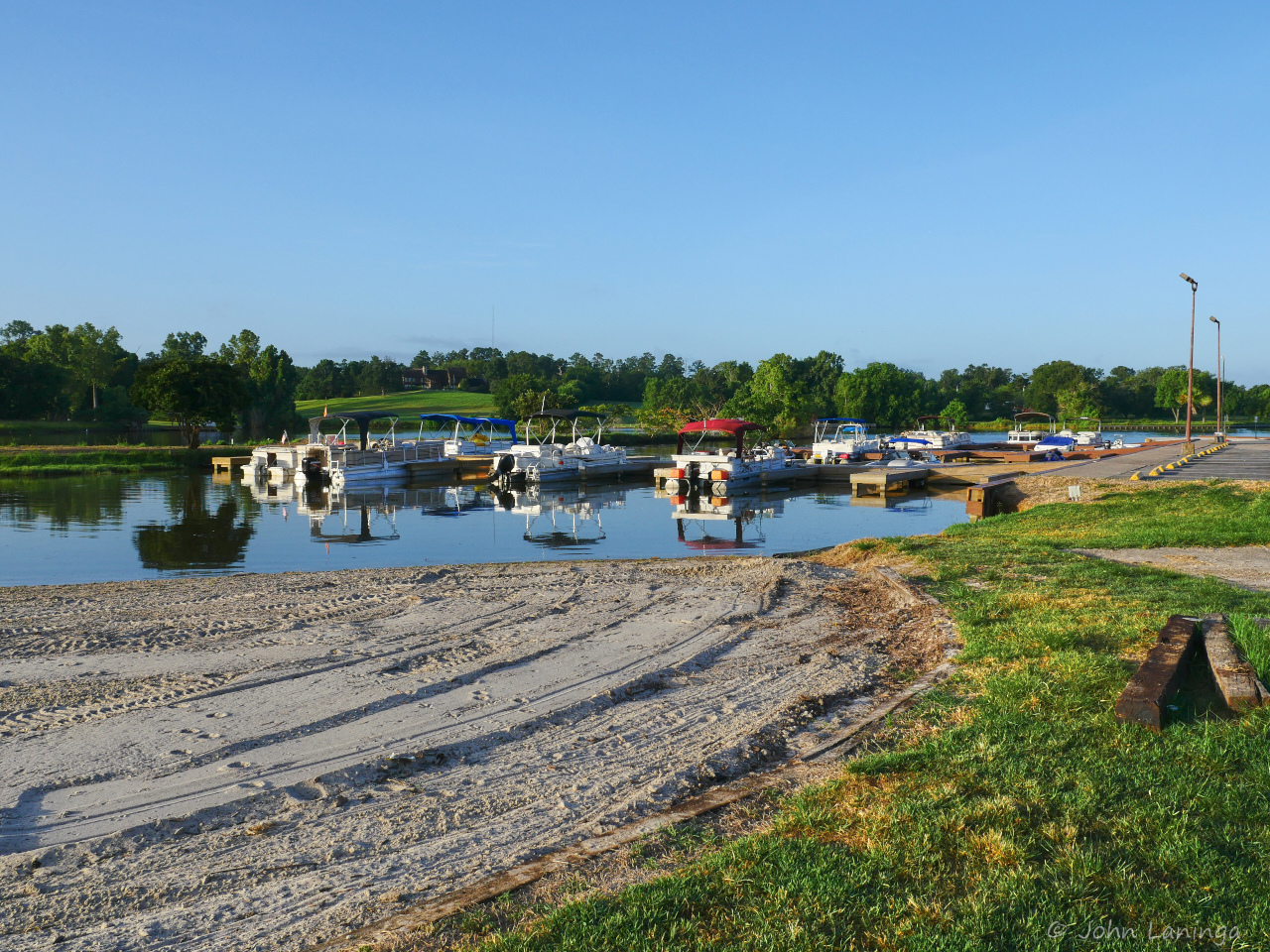
Boat docks, has about 20 boat slips
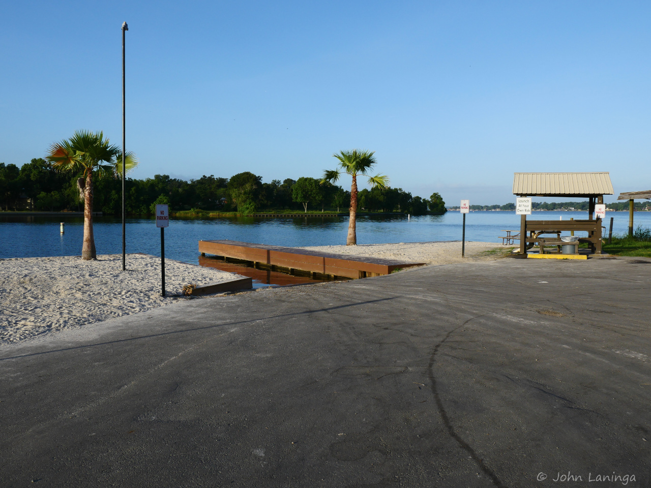
Boat launching area, fish cleaning station on right
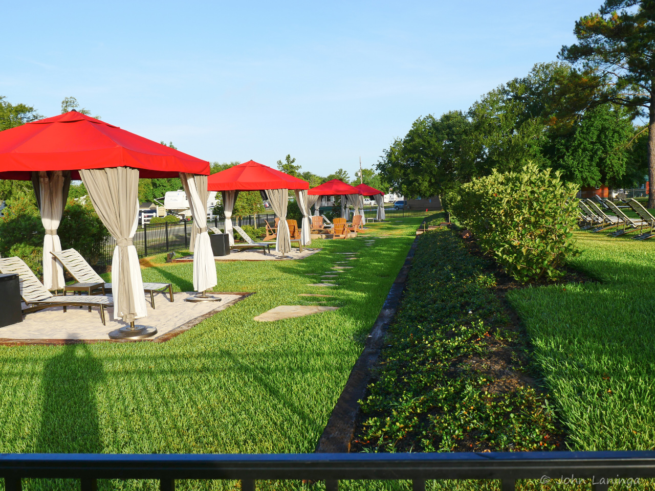
Swimming pool cabanas, each with a fridge!
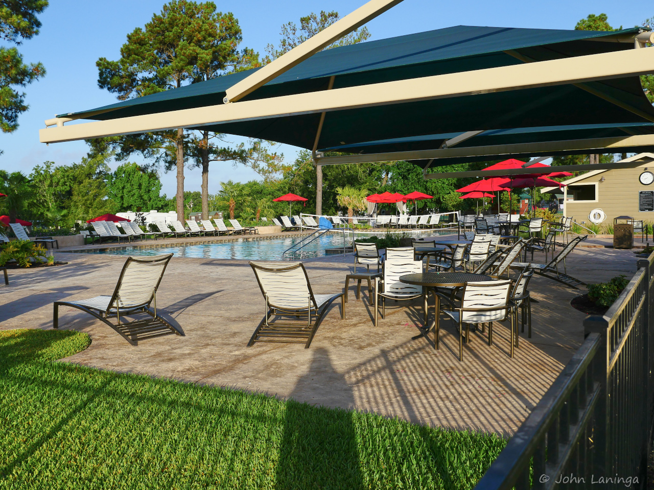
Pool side shade
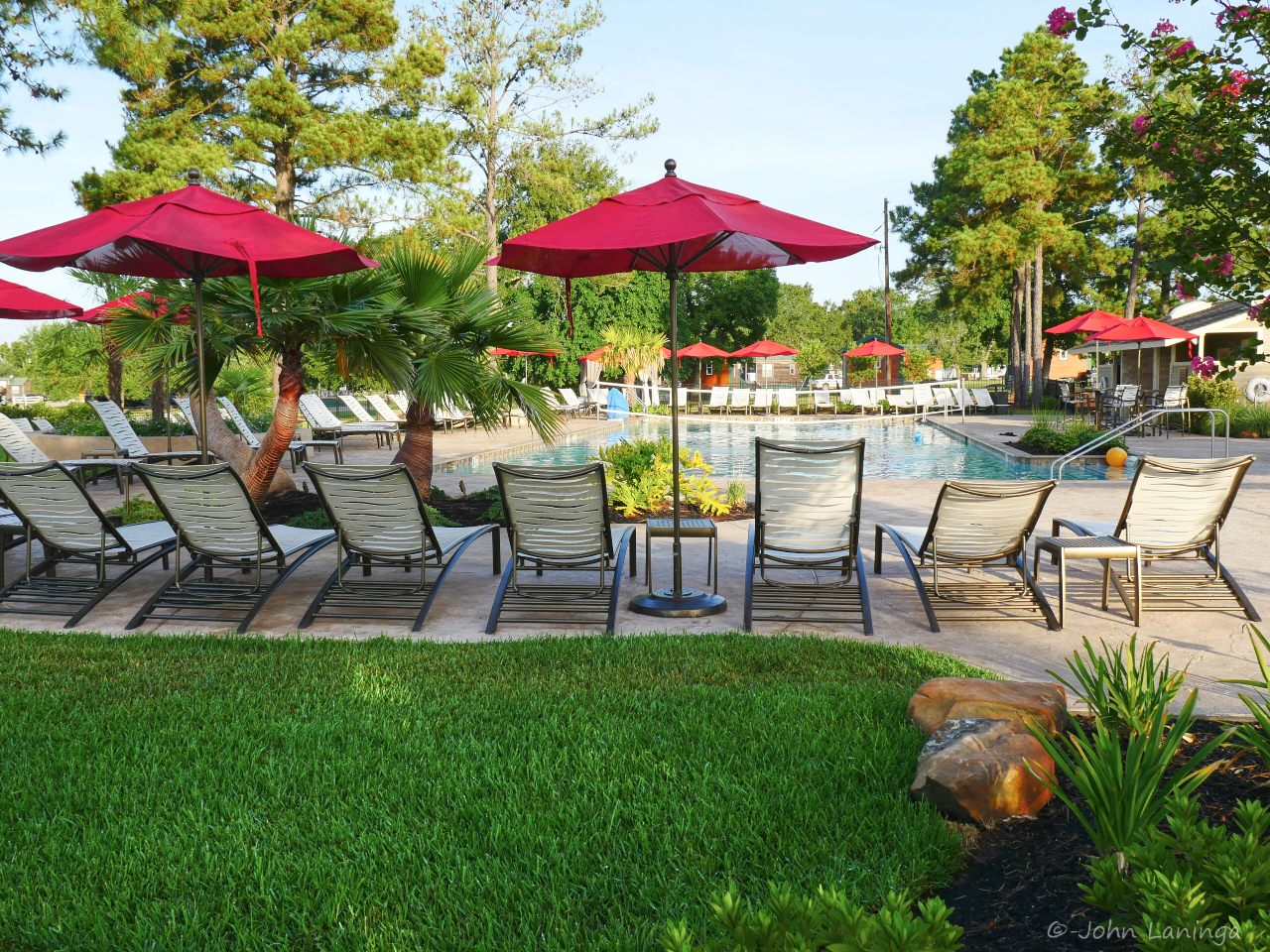
Pool area
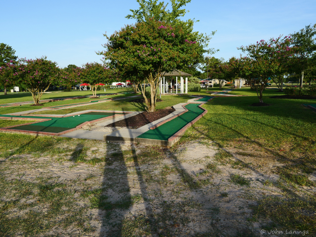
Miniature golf course
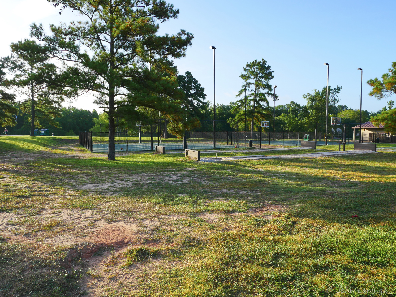
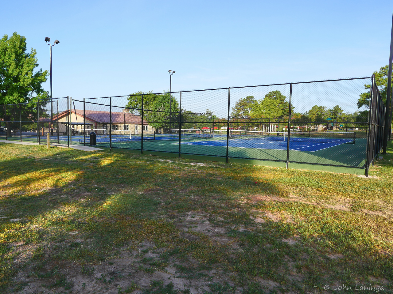
Tennis and pickelball courts
Basketball courts
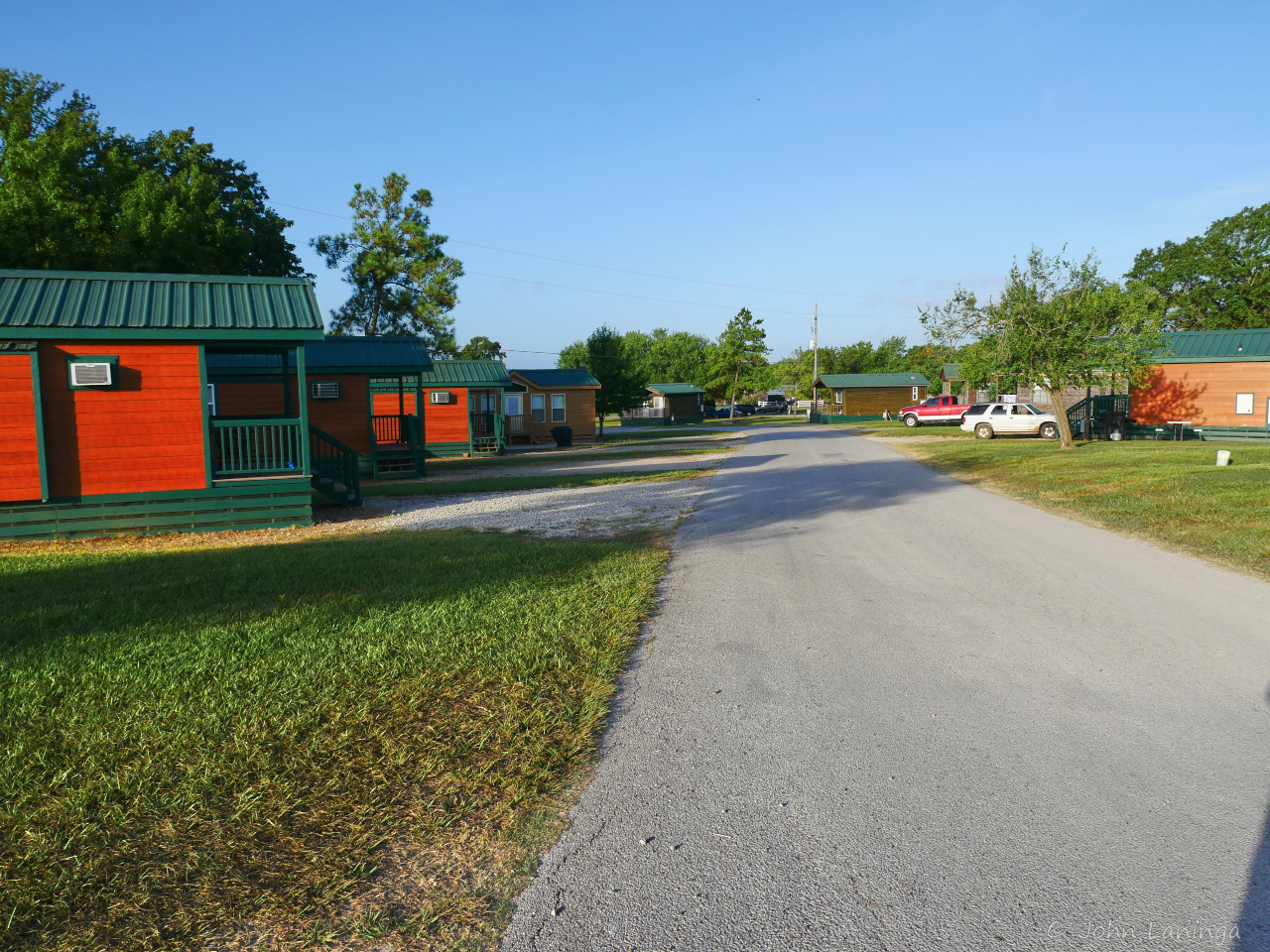
No RV? Fear not, there are cabins
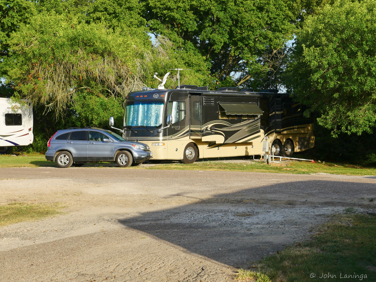
A different angle of our site, our car parked in front
Santa Fe, New Mexico
Santa Fe is one of the top tourist destinations in the country. And why not, it has a strong history; it’s roots go back to the 1050’s Pueblo Indians. Many cultures make up today’s population, including Indian, Mexican, and Spanish eventually being as we know it today. It is the oldest, and highest, capital city in the USA.
Although it is a desert city, it is only 15 miles from the Sangre de Cristo Mountains. Architecturally, it has adopted the Spanish Pueblo look, often referred to as Adobe, with thick walls to help even out the rather drastic temperature fluctuations. Santa Fe is also known for food, with heavy emphasis on spices and strong local flavors. And the art scene is well known with many galleries and exhibits.
Less well known, during World War II Santa Fe was the location of a Japanese American internment camp. The site was also used to hold German and Italian nationals. In 1943, the camp was expanded to take in 2,100 men of Japanese Americans who had renounced their U.S. citizenship. The camp was closed and sold of in 1946.
We enjoyed our week in Santa Fe and learning more about its culture, its food, its art and also some very nice hikes!

A rainbow over the foothills

Adobe style architecture

Cathedral Basilica of Saint Francis of Assisi

Cathedral statue

Thriving farmers market

Yummy breads

The old RR station is still used, also as part of the Farmers Market

Hiking in the foothills

A view back to Santa Fe

Making a lazy afternoon

Sunup at Santa Fe
Chimney Rock, Colorado
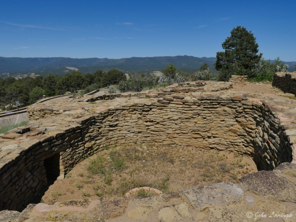
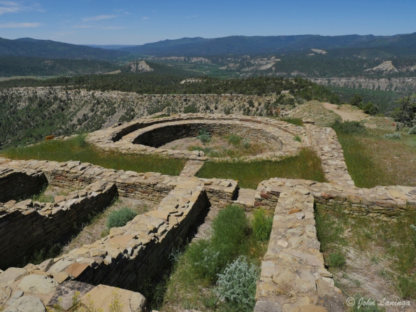
Chimney Rock is an Ancestral Puebloan site, designated on the National Register of Historic Places in 1970. It was a community inhabited between Durango and Pagosa Springs about 1,000 years ago with about 200 rooms. Rooms in the buildings were used for living, work areas and ceremonial purposes.
Housing approximately 2,000 ancient Pueblo Indians between A.D. 925 and 1125, the settlement included a Great House Pueblo with round ceremonial rooms, known as kivas, and 36 ground-floor rooms. A grizzly bear jaw found in one of the rooms when excavated suggested a reverence for the animal, and modern Chaco oral history suggests that the Bear clan originated in the Chimney Rock area.
The construction of the Great House Pueblo at the top of the ridge, close to Chimney Rock and its neighbor Companion Rock, had a large ceremonial role in the later years of Chaco presence. As the moon makes its lunar cycle across the sky over a period of 18.6 years, it appears in a “lunar standstill” between the two rocks for a period of approximately 2 years.
The inhabitants of Chimney Rock abandoned the site in 1125, burning the buildings when they left. Their modern day descendants consider the site sacred with the spirits of their ancestors, and have asked the Forest Service to refrain from further excavation out of respect.
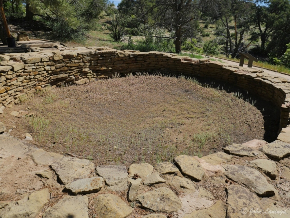
A Kiva in the lower village
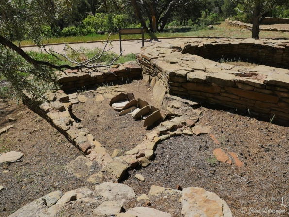
Work area (grinding corn) in the lower village
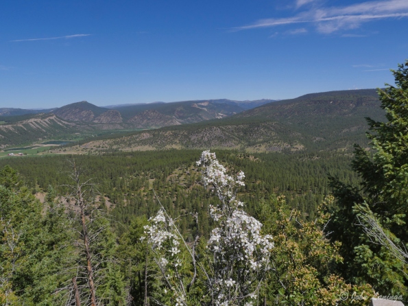
Sure is a magnificent view from up here!
Inside the Pueblo Village walls

It’s a bit of a walk to get to the Great House
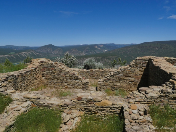
Inside the Great House walls
Showing some of the complex structure of the Great House
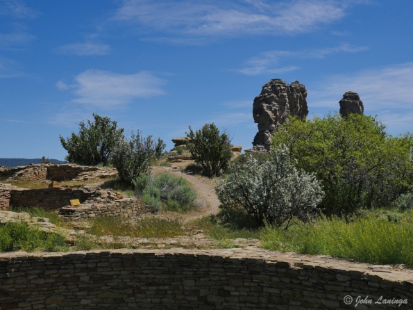
A view of Chimney Rock, viewed from the Great House
Creede, CO & Bachelor’s Loop
Creede, CO at one time was one of the biggest silver mines in the country. Creede was the last silver boom town in Colorado in the 19th century. The town leapt from a population of 600 in 1889 to more than 10,000 people in December 1891. The Commodore mine is now disappearing, but it has 5 different levels spread out over 200 underground miles.
Creede’s boom lasted until 1893, when the Silver Panic hit all of the silver mining towns in Colorado. The price of silver plummeted and most of the silver mines were closed. Creede never became a ghost town, although the boom was over and its population declined. After 1900, Creede stayed alive by relying increasingly on lead and zinc in the ores. Total production through 1966 was 58 million troy ounces (870 metric tons) of silver, 150 thousand ounces (4.7 metric tons) of gold, 112 thousand metric tons of lead, 34 thousand metric tons of zinc, and 2 million metric tons of copper.
During it’s heyday, the Colorado Capital (Denver) enacted major legal reform movement against gambling clubs and saloons. Numerous owners of major gambling houses in Denver relocated to Creede. Among them was the infamous confidence man “Soapy” Smith, soon the uncrowned king of the criminal underworld. Other famous people in Creede were Robert Ford (the man who killed outlaw Jesse James) and Bat Masterson.
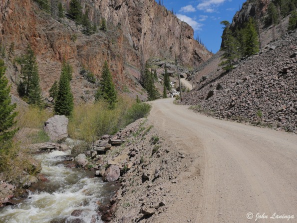
After touring the Mining Museum (very well done, by the way), take a drive through Bachelor’s Loop. That is, if you don’t have a fear of heights. Also, best to have a 4 wheel drive vehicle. There are some very steep sections, some very narrow sections, and all gravel. But it is definitely worth the time because the views are just stupendous. And if you have a real 4 wheel drive vehicle you will find miles and miles of old roads and ghost towns.

The drive into Creede shows why it is a mining town

Those were some tough and dangerous jobs!

Working at the face of the mine

Sometimes you had to go down to get ore….
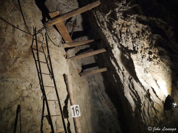
And sometimes you could just follow the vein.
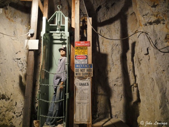
Not a very roomy trip down (or up) to the different levels

The gravel road takes you up to the Commodore mine

One of the main Commodore mine structures
The road is quite rough, steep, and narrow
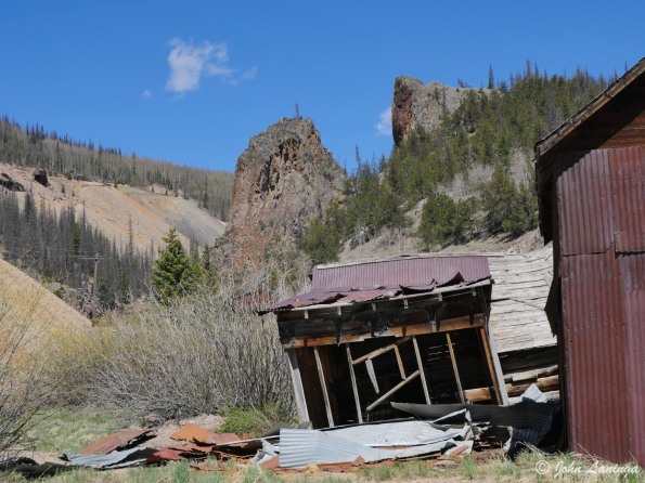
A different mine complex perches on the steep hillside
At the top is a peaceful valley with the headwaters of the Rio Grande river

Coming back down to Creede

Said to be the highest church in the USA
Ouray, Silverton, and Million $$ highway
Ouray is an old (1870’s) Colorado mining town turned tourist town. Often called America’s Switzerland, it is located high in the mountains. Although it still has an active mine, most city revenues come from tourists. There are many cute and interesting cafes, restaurants and hotels in town. We’ve sampled a few….
Likewise, Silverton owes its origins to silver mining. And, like Ouray, it exists today mainly due to tourists. This is helped because it is the end of the Durango & Silverton Narrow Gauge Railway, which still uses steam locomotives and old rolling stock. The train ride, starting in Durango, is a magnificent scenic tour of the Colorado high mountains. Silverton’s entire downtown is registered as a National Historic Landmark.
To get from Silverton to Ouray, you have to take the “Million Dollar Highway”, so named because legend has it that cost a million dollars per mile to build. Another legend says that over a million dollars of gold is in the fill dirt used to construct it. In any case, better not be afraid of heights, because the road is narrow,with steep dropoffs, and many sharp curves, But it is a beautiful drive.

To get to Silverton, you have to cross several passes

A view descending into Silverton

Downtown Silverton

Yep, curvy road and big dropoffs!

Downtown Ouray

Hotel in Ouray

Water fall from way up high

Mountains surrounding Ouray
