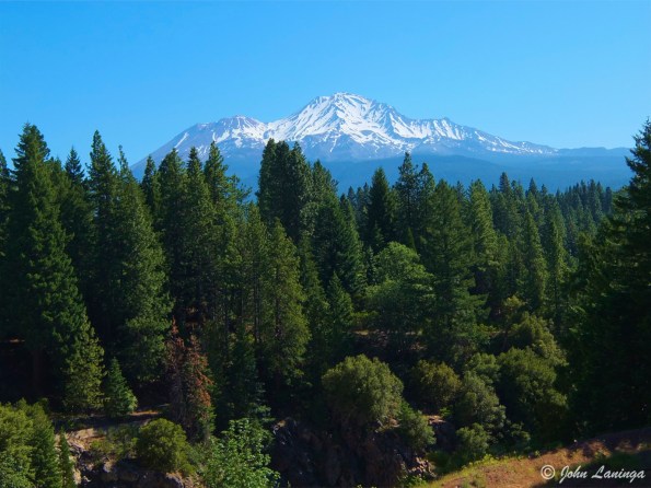
Mt. Shasta, CA area
We spent a few days in Mt. Shasta, CA. Beautiful area, high mountains, waterfalls, meadows and lakes. The upper mountain trails were still closed due to winter snows, sure hope to come back here for more hiking.
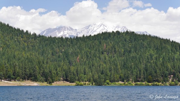
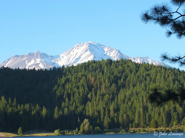
Mt. Shasta from our camp site
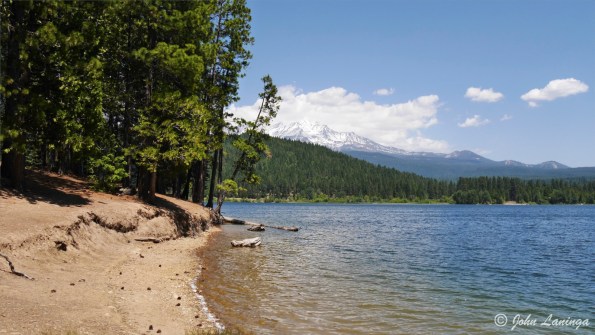
Lake Siskiyou shore at our camp site
Mt. Shasta from Lake Siskiyou
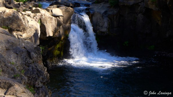
Lower McCloud Falls
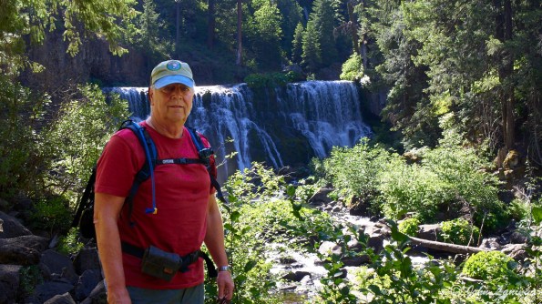
At Middle Falls
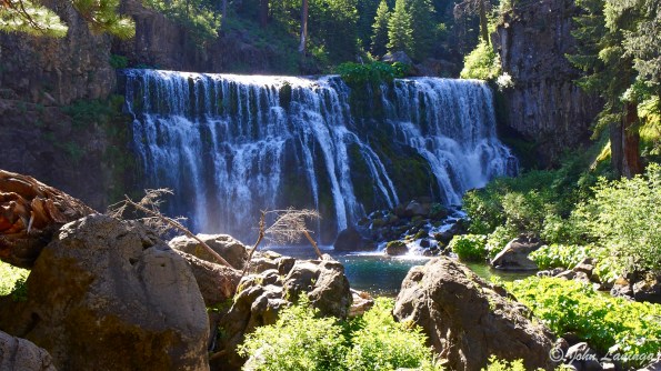
Middle Falls, McCloud River
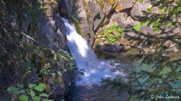
Upper Falls, McCloud River
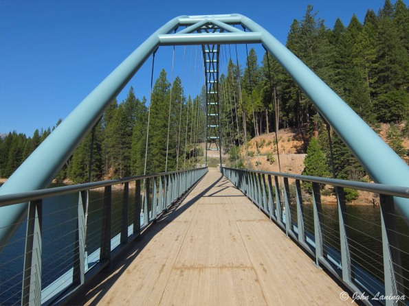
A pedestrian bridge on the Lake Siskiyou hiking trail
Dogwood (?)
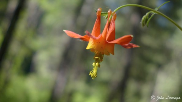
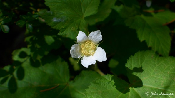
Wild flowers
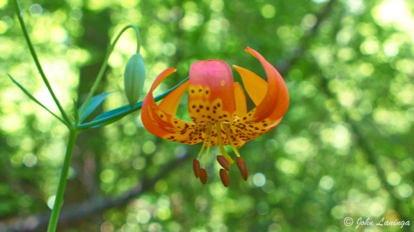
Wild Flower

Green Rocks, a 500 million year old rock formation
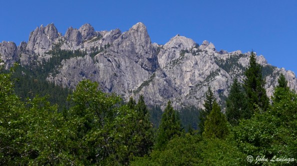
Castle Crags, granite, and 150 million years old
Mt. Shasta, volcanic, and 500,000 years old
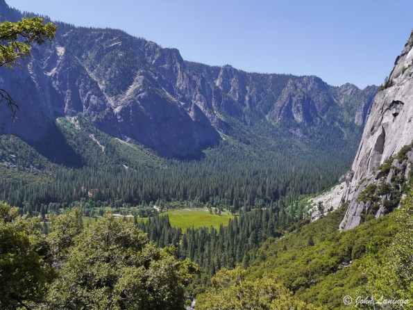
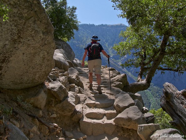
Yosemite Falls
Yosemite Falls are the highest falls in the US. And probably the most photographed, too! There also are several hiking trails; the Lower Falls is paved, wheel chair accessible, and very crowded. The Upper Falls trail is steep, rocky, and gains almost 3,000 ft. in 3 miles.
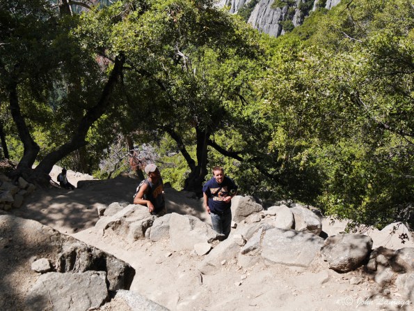
We first did the lower, then went halfway up the Upper trail to Columbia Rock. Whew, that was enough for us! But great picture opportunities along the way.

A view of Lower and Upper Yosemite falls
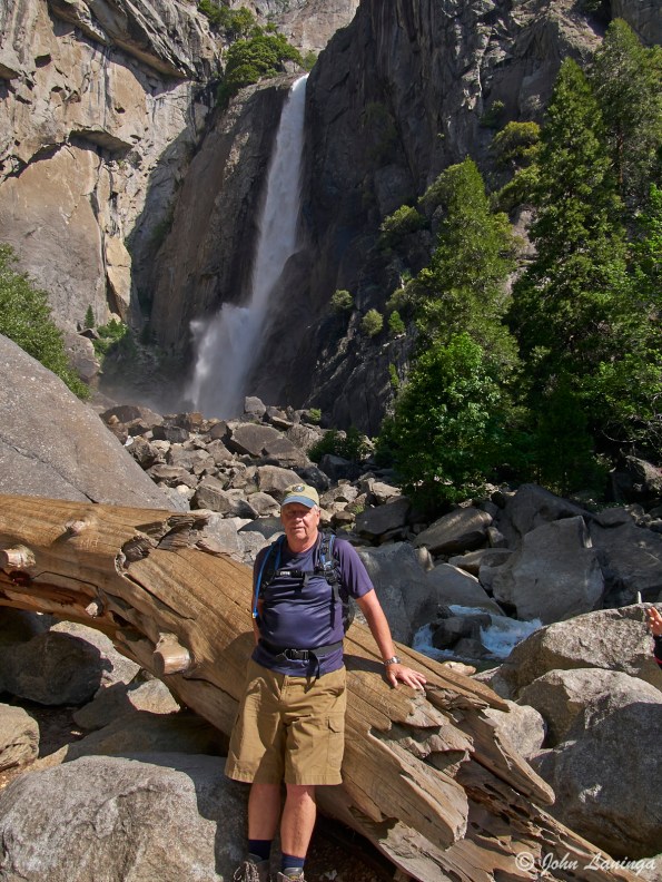
John, posing at the bottom of Lower Falls
Halfway ip, and the view gets serious!
If you don’t think it’s steep, look where you just came from
Romola on her way up
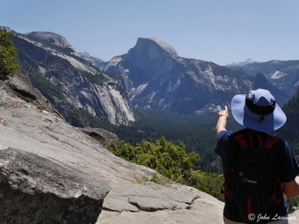
Romola pointing toward Half Dome
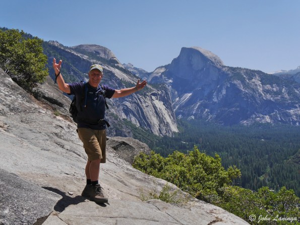
Yeah! We made it half way!
Las Vegas at night
During the last week, we visited several Las Vegas areas at dusk and at night. There are so many lights here! And I wanted to take some pictures of night time Las Vegas. Below are pictures taken on Fremont Street (downtown Las Vegas) as well as the always busy Strip.

Caesar Palace shops

Ceiling in the Forum Shops

Caesar Palace

Fountains at the Bellagio

Some very large signage

Craftsman showing spray paint paintings

Point your camera, and they will pose

Inside the Fremont street LED display


Clever images on the ceiling

And, a variety of colors
Valley of Fire, Nevada
The Valley of Fire is located less than an hour north of Las Vegas, close to Lake Mead. It gets its name from the bright red rock formations, but also because it gets to be over 120F (50C) in the summer.
One area is known as “Mouse Tank” and contains a valley filled with Indian petroglyphs. Even though time is starting to erode them, it is still possible to make out the huge amount of indian art.
But there is more to it. There are many geologic formations of different colors and different shapes, giving an erie effect to the landscape. Perfect for hiking, and photography.

Very sandy in many places.

Slot Canyon

Baby arches (?)

“Fire Wave” – unique formations
 Hard to see, but lots of petroglyphs[/caption]

Closer view of Indian petroglyphs

Lava formations as far as the eye can see
“Lost” in the dessert
Thought a hike would be in order before it got too hot here in Vegas, so elected to do the Potato Knoll hike in Red Rock Canyon. Just under 5 miles, very little elevation to worry about. Off we went, but did add water before we left… and a good thing, too.
Turns out there are many side trails, and most are not marked. You guessed it, we followed the wrong trail. We realized that we were unsure where we were, and where we were going. But we knew the general direction of the parking lot. After a lot of trial and error, we cut cross country, where we thought the parking lot was located. At last, we could see the parking lot from a rise. Excellent, so we headed for it. Wrong parking lot, Oh well, at least we were on the road and another 1/2 mile walk brought us back to our car.
We never were in real danger, we had water and emergency supplies, and cell phone coverage, although spotty,ensured we could always have a way out. In the end, we enjoyd our somewhat linger hike.

From the parking lot. Potato Knoll far ahead

At first, trail is easy to follow

Then it becomes more hard to find

But the cactii were beginning to bloom

OK, we’re behind the knoll, which way?

Maybe this way?

Or thgis?

Beautiful desert surroundings, thougn
Zion: Angel’s Landing
Angels Landing is one of the classic hikes in Zion and one of the most stunning viewpoints you will ever experience, but it’s not recommended for anybody with a fear of heights. Starting at the Grotto Trailhead, the hike to Angels Landing follows the longer West Rim Trail backpacking route up and out of the west side of the main canyon. Angels Landing is unique fin-like mountain formation that juts out to the center of the main canyon.
After a rather steep and winding climb from the Virgin River, you get a nice respite in Refrigerator Canyon, where it always is cooler than the rest of hike. Then, you reach Walter’s Wiggles, a steep climb with 21 switch backs. A bit of an exertion here! Then you reach Scout’s Landing, an open space with magnificent views.
Those who are braver than us finish the last 1/2 mile along a steep path with dropoffs of 1,500 feet. A final crossing of a spine with 1,500 dropoffs on both sides brings you to Angel’s Landing itself. Like many others, we passed on this last part, which is rated as one of the three most dangerous hikes in the USA.
After a the hike we managed a quick stop at the Three Patriarchs, a magnificent set of mountain peaks next to the Virgin river.

A river’s side view of Angels Landing


Entrance to “Refrigerator Canyon”

Looking up to Walter’s Wiggles

And looking down Walters Wiggles

A view back from Scout’s Landing

Looking down deom Scout’s Landing into the valley

Showing how tenuous the last 1/2 mile gets

A line of hikers starting the last 1/2 mile

A cactus flower, blooming alongside the trail

A vie of the Patriarchs

Another view of the Patriarchs
Bryce Canyon
Bryce Canyon is unique in that visitors view the canyon from the top down, instead of from the bottom up. This provides a unique viewpoint of the distinctive geological structures called hoodoos, formed by frost weathering and stream erosion of the river and lake bed sedimentary rocks. The red, orange, and white colors of the rocks provide spectacular views for park visitors. Bryce sits at a much higher elevation than nearby Zion National Park. The rim at Bryce varies from 8,000 to 9,000 feet.
We drove over with some of our friends of the Pikes Peak Rollers, our Colorado RV travel group. We were going to stop over at Cedar Breaks, but recent snowfall closed the road. But we still got to see some snow over the pass!
Romola and I also hiked down into the canyon (Navajo Trail). It’s spectacular, looking up at the hoodoos instead of just down! Makes the tough hike back up worth it.

Rock formation at Red Canyon, on the way to Bryce

Wayne Pedersen with Romola at the summit

Yep, that’s snow!

#1

#2

#3

#4

#5

#10

#6

#8

#9

#7

Steep trail back up

Twin bridges

Hiking down the canyon
Grafton, UT – ghost town
Not far from Zion NP is an old town named Grafton. It was originally started by Brigham Young grow cotton. It was a small but busy little town in the 1800, but suffered from floods, Indian reprisals, and Virgin river flooding. And, the ground was silty, making crop growths difficult. Eventually, the resident moved away, and the town was abandoned.
An attempt to revitalize the town was made in the 1930’s, especially to house road crews who were building the nearby highway. But the biggest use was in the 50’s and 60’s as a setting for Western movies. Many were made here, the most memorable being “Butch Cassidy and the Sundance Kid”. Now, it is a tourist attraction, if you don’t mind the bumpy road to get there.
We passed a sign that said “do not enter when wet” and once we were at the town rain threatened, but we didn’t have any difficulty. Nice trip!

Headstone of a family killed in Indian raids

Church

House

Old shed

Rear view

Wagon

Oops!
Zion: Emerald Pools
There are three sets of pools in Zion known as Lower Emerald, Middle Emerald, and Upper Emerald Pool. There is one hike that goes to all three, which we’ve done before. However, we decided to just go as far as the Middle Pools, and then hike to the Grotto to catch the bus for Riverside.
The Riverside hike is really a mile long paved walk. At the end, you can keep going, but you have to hike (and possible swim!) in the river. You can get tours that rent you dry suits and special shoes, but since we were not so equipped, we just made a nice walk from it.
The tram system (free) is a great way to get to all the different trails in the park. And it helps cut down congestion as well as pollution. Such a magnificent park!

A view down the Virgin River

Rain on the trail!

Rather steep climbing in places

The trail narrows

Middle Emerald Pool

Scenic vista

End of the paved trail, start of the water trail
Antelope Canyon, Utah
We were scheduled to spend one night in Page, AZ on our trip from Farmington to Zion. When we got there I was surprised to see that we were right next door to Antelope Canyon, someplace I have always wanted to visit. I called to get a reservation (you have to go in with a Navajo guide) and luckily one was available the next morning!
Terrific visit. It was a wild ride in the back of a pickup, 10 minutes at highway speed and 10 minutes through the sand. But it was definitely worth it! Here are a few pictures.

We went to the canyon in one of these pickups

— #1 —

— #2 —

— #3 —

— #4 —

— #5 —

— #6 —
