Archive
Great Sand Dunes, Colorado
Today our adventure took us to the Great Sand Dunes, about 25 miles from where we are parked in Alamosa, Colorado. It was quite a spectacular trip, seeing all this sand in the middle of the valley, and surrounded by mountains. We had a nice hike, climbing high in the hills to get a spectacular views of the dunes.
The dunes were formed from sand and soil deposits of the Rio Grande and its tributaries, flowing through the San Luis Valley. Over the ages, glaciers feeding the river and the vast lake that existed upon the valley melted, and the waters evaporated. Westerly winds picked up sand particles from the lake and river flood plain. As the wind lost power before crossing the Sangre de Cristo Range, the sand was deposited on the east edge of the valley. This process continues, and the dunes are slowly growing. The wind changes the shape of the dunes daily.

One of the many 14,000 ft high mountains along the way.

A view of the dunes with some of the mountains

Here you can see one of the rivers that feed the dunes

A little posing along the way

Looking back from the top of the Lookout hike

Many people cross the river to hike in the dunes
Murals of Conejos County
Deep in the heart of the San Luis Valley, you can find a impressive set of murals. These murals, painted on structures on public as well as private land, reflect the history of this area. Most of these were by Fred Haberlein, known locally as “Lightning Heart”. He is one of the most prolific mural painters in the country. To see these murals, you will have to drive almost 100 miles through very rural USA. Some roads are even dirt, but the trip is worth it.
Below are a few of the highlights.

“Shepherd’s Sunrise”, La Jara

“Whooping Cranes”, Romeo, CO


“The old Plaza at Conejos”, Conejos, CO (Inside post office)

“Walking in Beauty”, Antonito, CO

OK, just had to throw in this fire plug

“The Great Water Serpent”, Antonito, CO

“Mimbres Rabbit”, Antonito, CO

“The History of San Luis Valley”, Antonito

“The History of the Conejos Region”, Antonito, CO

“Bronco Busters”, Manassa, CO

“The Rams”, La Jara, CO

Unknown, in Alamosa, CO
A quick hike
Colorado Springs is a neat city in a great location. Today we did a quick hike, on a trail system starting in the city limits. The recent rains has made for a lot of mud, but we had a nice hike anyway. Not shown in the pictures is the wonderful view of Pikes Peak, which today unfortunately was somewhat hidden by the clouds.


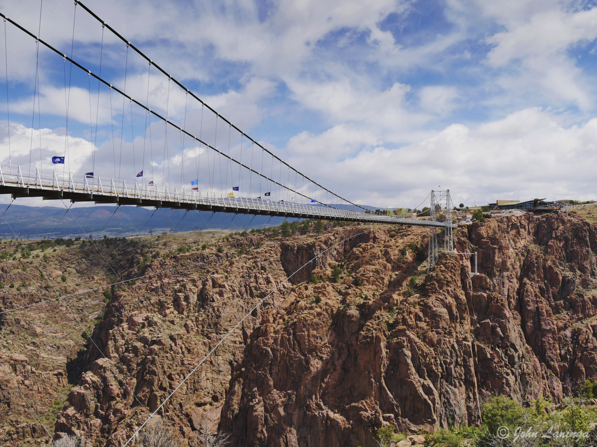
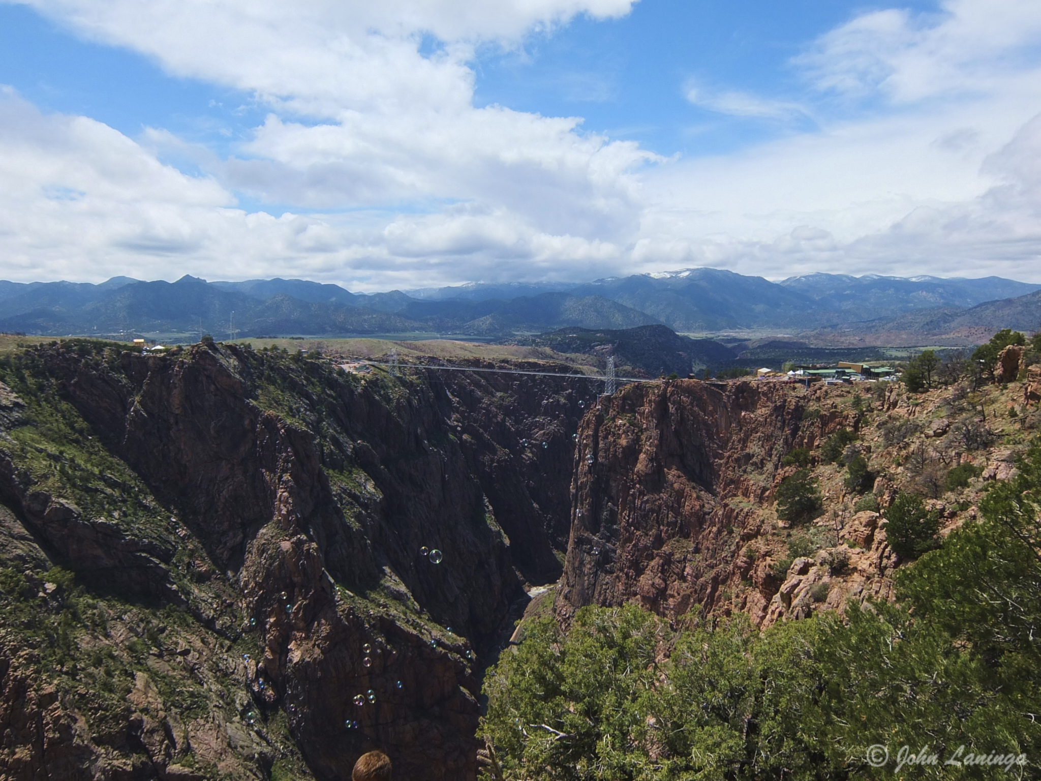
Royal Gorge, Colorado
The Royal Gorge (also Grand Canyon of the Arkansas) is a canyon on the Arkansas River near Cañon City, Colorado. With a width of 50 feet (15 m) at its base and a few hundred feet at its top, and a depth of 1,250 feet (380 m) in places, the 10-mile-long canyon is a narrow, steep gorge through the granite of Fremont Peak. It is one of the deepest canyons in Colorado.
In the early 1900’s, Canon City wanted a different water source and built an 8 mile long water pipeline. It was made from California redwood, and was used until the 1970’s. The wood is still in such good shape that it has been declared a Historical Site to prevent people form taking it all.
This stretch of the Arkansas River is one of the busiest white water rafting areas in the country. Couple that with many zip lines, some across the canyon and some connecting different areas, this is a very popular tourist attraction. There are many ways to visit and see this scenic wonder— from a train in the canyon bottom, on a bridge (or gondola) at the top, or hiking along the rim. The weather cooperated just enough so we could do all three. And, if you are brave, you can take a zip line across the top of the gorge (no, we didn’t).
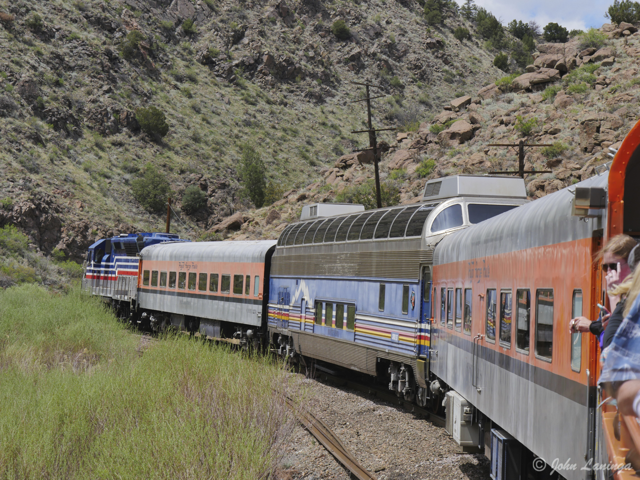
The train heads into the Gorge, starting in Canon City
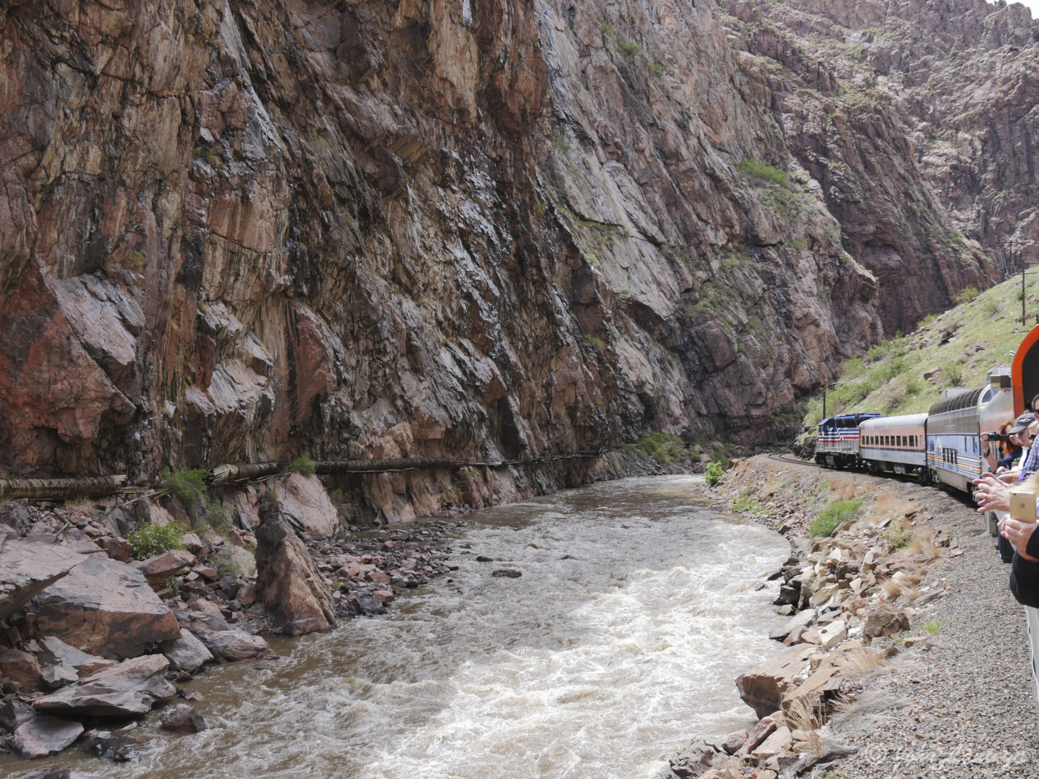
On the train, heading into the narrow part of the Gorge (note water pipe on left)
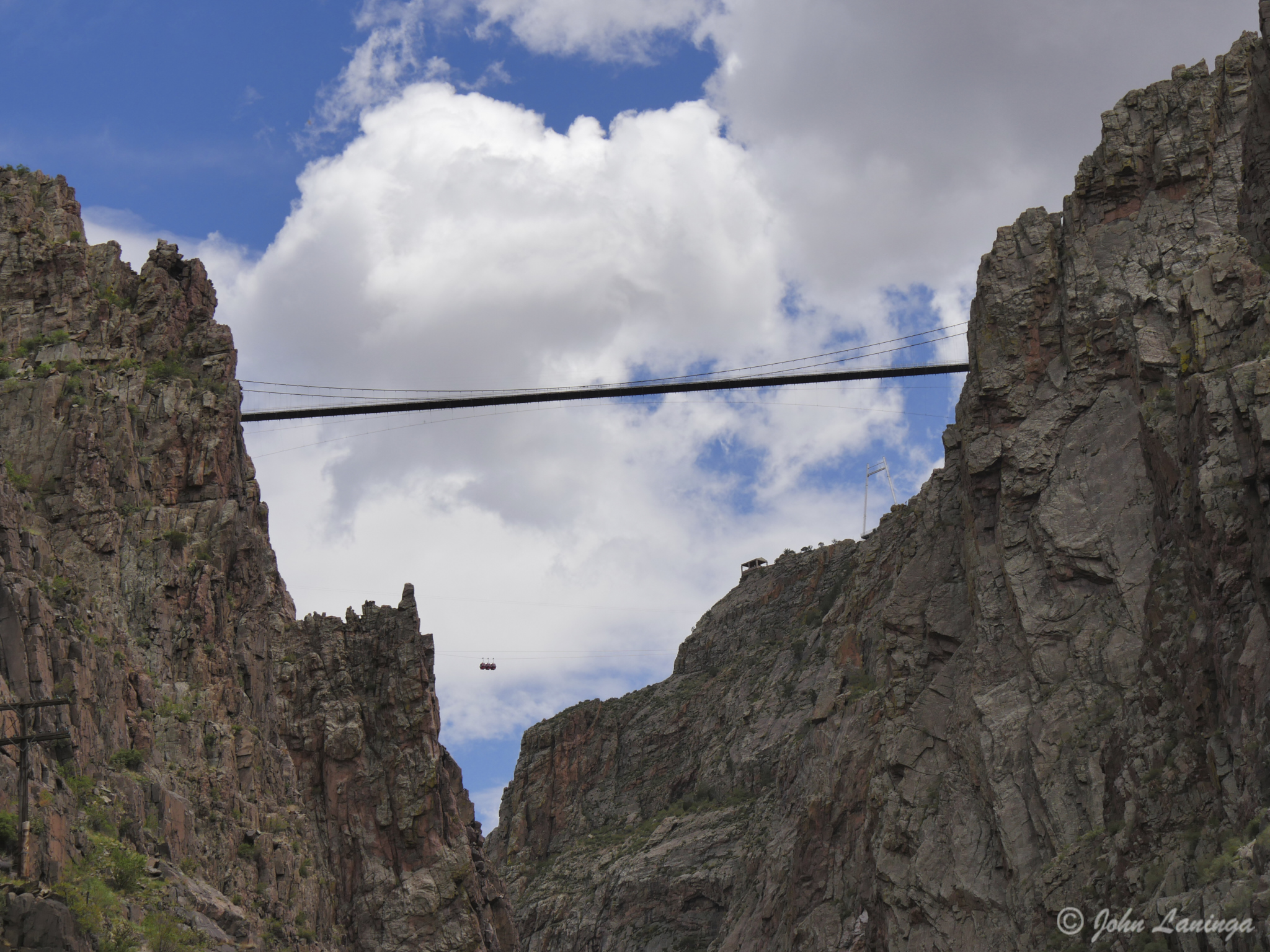
Looking up, at the Bridge (can you see the gondolas?)
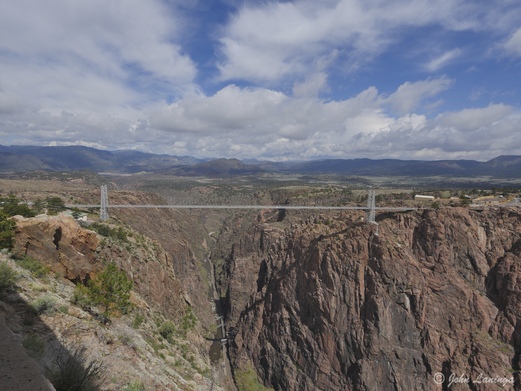
A wide angle view of the bridge
The bridge, viewed from the south end
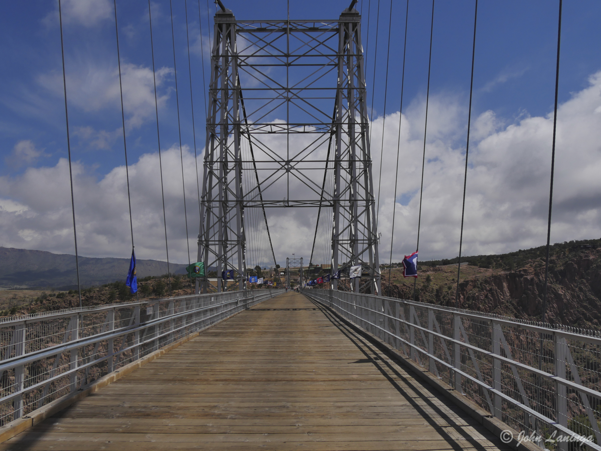
Looking down the bridge itself
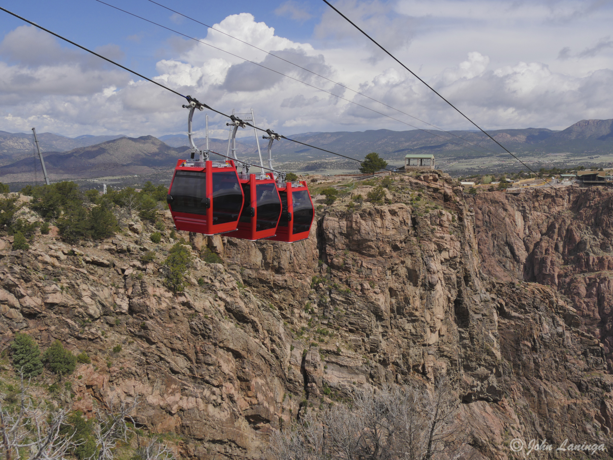
Closeup of the gondolas
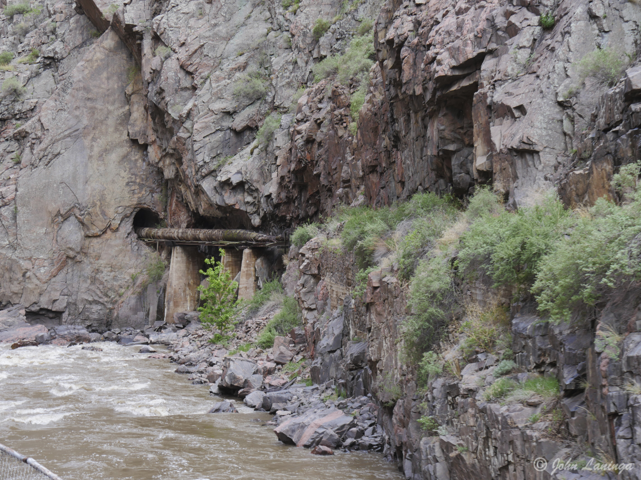
Another part of the wooden water pipe. All the tunnels were hand dug!
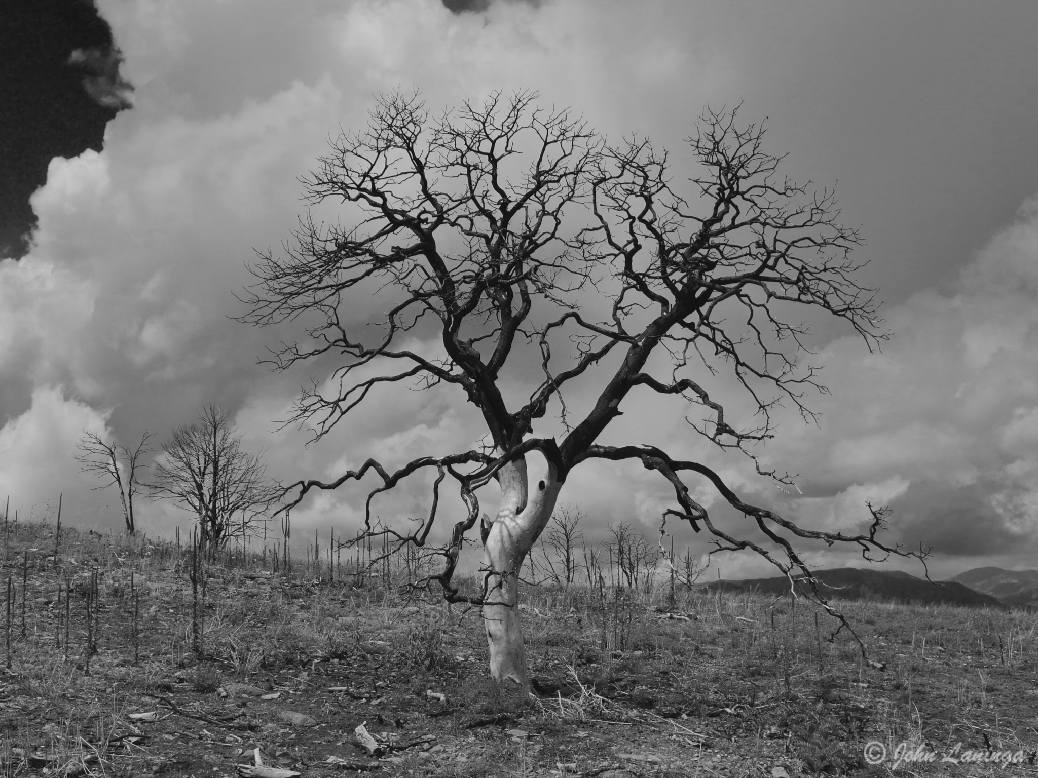
A black and white “art shot” of a tree burnt during the fire of 2013
A view of the bridge from the rim hike
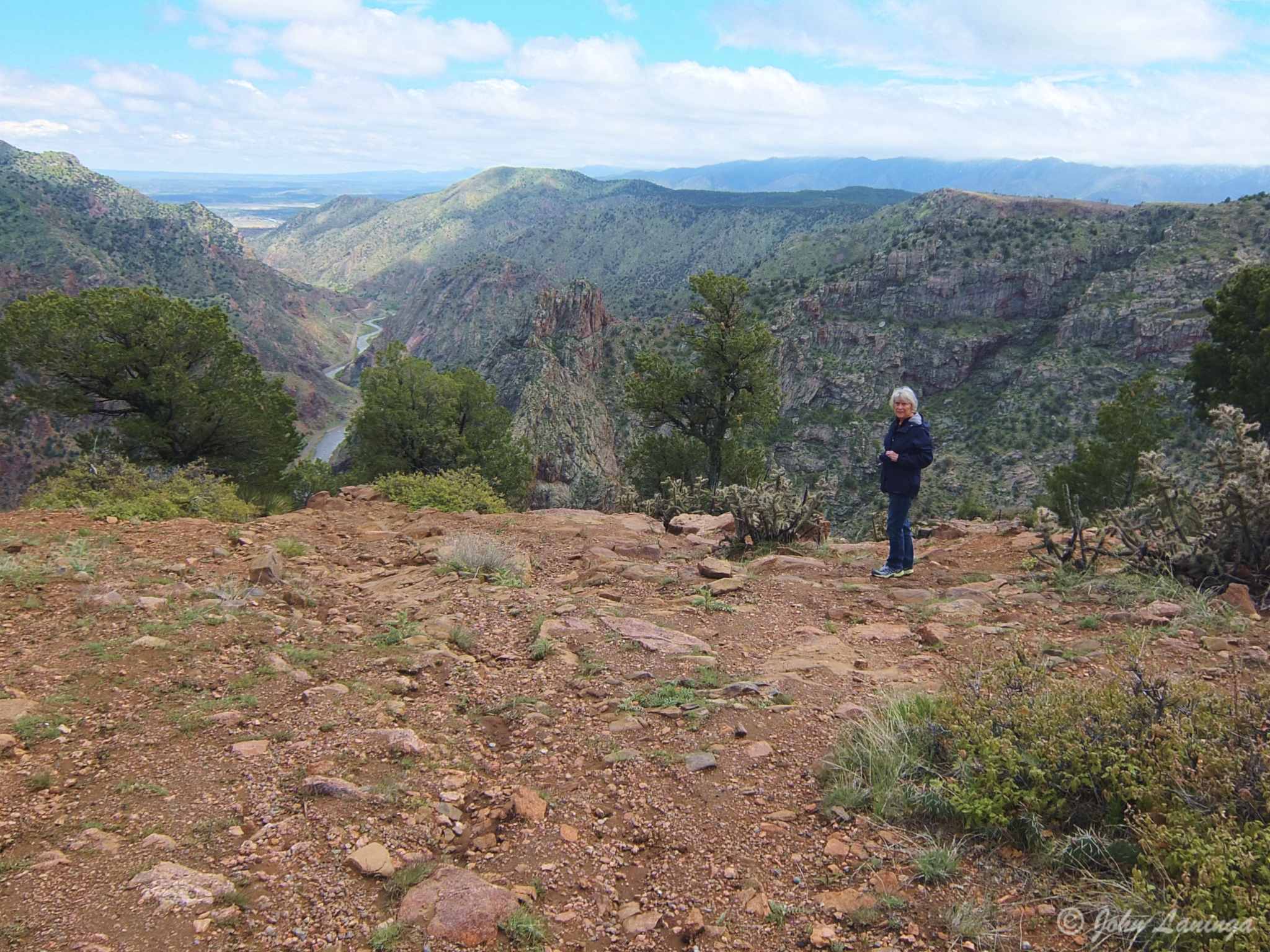
Romola standing at the rim of the Canyon
Salida, Colorado
We are parked in the 4 Seasons RV Park in Salida, Colorado. We are here for a rally with our friends of the Pikes Peak Rollers. It’s nice to catch up with old friends, enjoy some good food, and appreciate the local scenery.
Founded in 1880, Salida was originally a railroad town and was a significant link in the Denver and Rio Grande Western Railroad. After World War II the railroad began pulling back its operations in Salida. Many residents in the 1950s, 1960s, and 1970s worked either in local ranching operations or commuted north to Leadville to work at the Climax Molybdenum Company. Today, the most prominent business in Salida is tourism, consisting of skiing at Monarch Ski Area, whitewater rafting, kayaking and outfitting, particularly on the Arkansas River. In addition, fishing in the Arkansas River is a big attraction.

On US-50, heading into Salida

A nearby mountain peak

An interesting house

Another stylish home

Not sure what this style is– Cape Code?

The Arkansas River runs right through town

A ranch, across from the RV Park

Fly fishermen in the Arkansas
Austin, Texas
A group of RV travel friends, members of the Traveling Supremes and friends, met and stayed in San Marcos, TX to visit the area. We had a fun time together, visited the many historical sites of the area, and of course sampled the local cuisine… barbecue!
Our first visit was to the LBJ library, where we had a chance to revisit the history of the LBJ presidency. This was followed by a visit to the Bullock Texas State History Museum, where we learned more about Texas and its founding. I highly recommend this to anyone, not just Texans… very interesting! That evening, Dave Phillips brought in the “Fajita King”, who made some excellent Fajitas from scratch.
Our next visit was to the San Marcos Springs, a natural spring site located on (or near) Texas State University. There we visited the aquarium and took a glass bottom boat tour to see the bottom of the lake and the springs themselves. A pot luck meal completed another satisfying day.
Then, another trip took us to the Texas State Capital building, where a guided tour introduced us to the largest state capital building in the US. The history of this marble building was a story all to itself. Most interesting! After this we visited the University of Texas, and went to the top of the Clock Tower, notorious for being one of first public mass murders in recent history.
A final meal at the Grist Mill in Gruene helped end a most interesting visit. Thanks to the Phillips and Hoovers for putting together a fun gathering!

The group at the LBJ Museum

Les, Ida, LBJ and Romola

The “Fajita King”!

View of the Texas Capital

Showing when the Capital was built

Looking down on the Rotunda floor

Looking up inside the Rotunda dome

State legislature

Down the east hallway

A view of the clock tower
Cruise, Cartagena Columbia
Although people have lived in this area for 4,000 year, it wasn’t until the mid 1500’s before the city as we know it was founded. Originally an important port for Spanish trade, it has withstood numerous attacks by foreign governments and pirates. A large part of this has been the construction of a major defensive wall, most of it still exists today.
The old city has a wall of some 9 miles long, and entrance is through the clock tower. Inside, you will find narrow roads, but colorful buildings, many with balconies with flowers and decorations. There are parks and museums, but it is hot here…. the average high temperature is 90F all year round!
Once outside the old city, it is a large and modern place. High rise apartments and office complexes as far as the eye can see. Truly a city with both the old and the new.
Below are some pictures; for a full album click on the Flickr link (below right) and click on Albums.

Clock tower and entrance to the old city


Colorful buildings

Showing off the local dress

Many works of golden art

The Inquisition Building, scene of awful tortures

Cartegena stree

Decorative door knocker

Colorful buildings

On top of the wall

A defensive outpost

Canons on the walls

Shopping in the shade

Colorful parrot
Cruise, Gatun Lake
In order to make the Panama Canal work, they had to flood a large valley. This lake is now called Gatun Lake, and houses a wide variety of wildlife. Much of this was viewed from a small boat. In addition to the usual birds, we even saw (and heard) a Howler Monkey. They are loud!
On the way to the lake, the bus made a quick stop so we could view a rare two toed sloth up in a tree. we watched, it climbed higher… and the branch broke and the surprised sloth was at our feet! An unusual experience.

A two toed sloth climbing a tree

A surprised sloth after his branch broke!

Oh well, go find another tree to climb.

Bananas growing in the wild

Noriega’s former headquarters, now a hotel

Small crocodile

A limpkin, looks like an egret

One of the many islands

A native indian hut

A sleeping howler monkey

Kiskadee
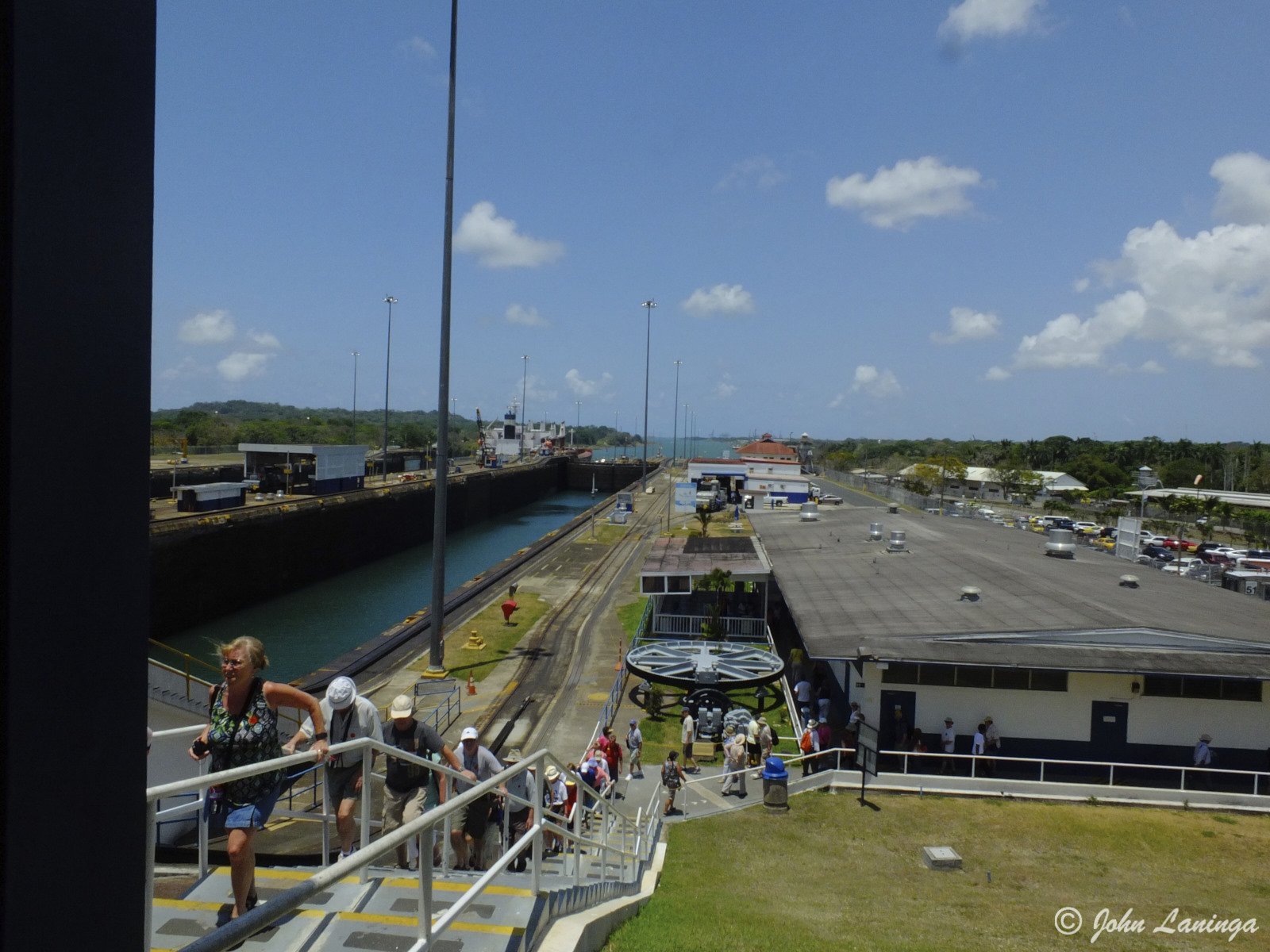
Cruise, Panama Canal
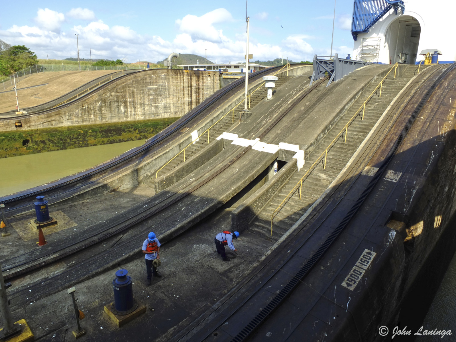
Certainly the Panama Canal was one of the highlights of our trip. After reading all about it, listening to lectures about it, and seeing the old movies about it, the trip through the canal was fantastic. Just seeing the place that had the huge political history, emphasized by the thousands who lost their life building it was thrilling.
Our ship, the Celebrity Infinity, was a “Panamax” ship, meaning it was as large as was allowed. Our ship, 985 feet long, just fit in the 1,000 foot locks… with 1 1/2 feet per side!
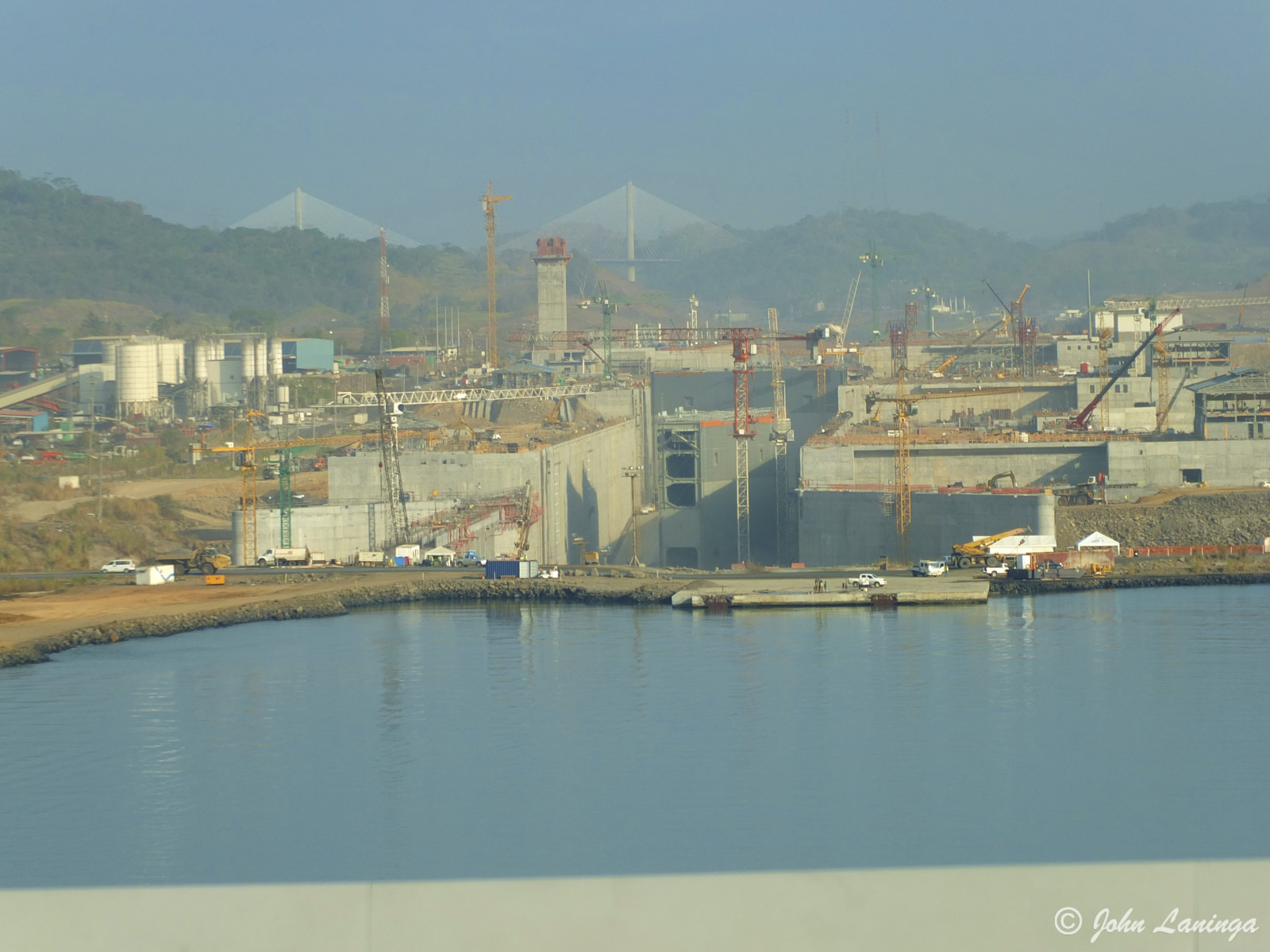
We were lucky enough to see the new locks being built on both the Atlantic and Pacific side. They are huge, each gate weighs over 350 tons! Once these are finished, shipping capacity will be dramatically increased.
It will be interesting to see if, and how, the proposed Nicaragua and Northwest Passage canals could affect the ongoing Panama operations.
As usual, all albums may be found by clicking on the Flickr link (lower right) and then clicking on Albums.
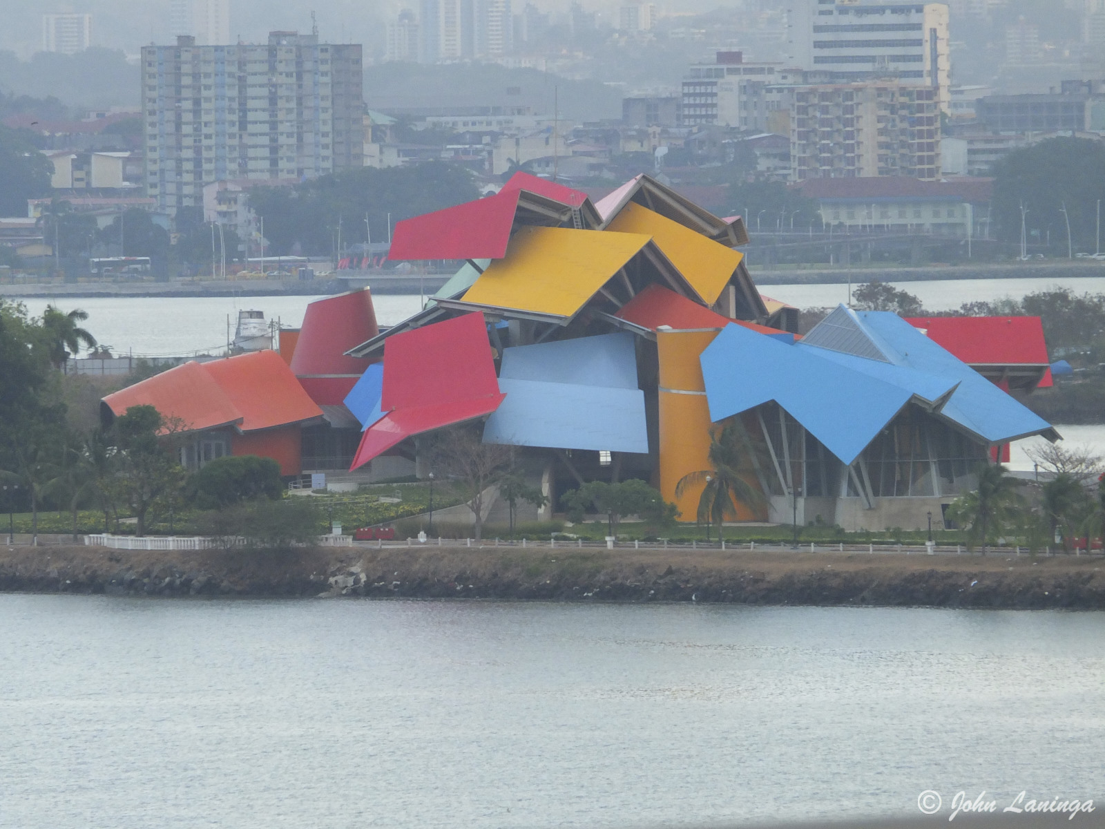
The museum at the Pacific side of the Canal
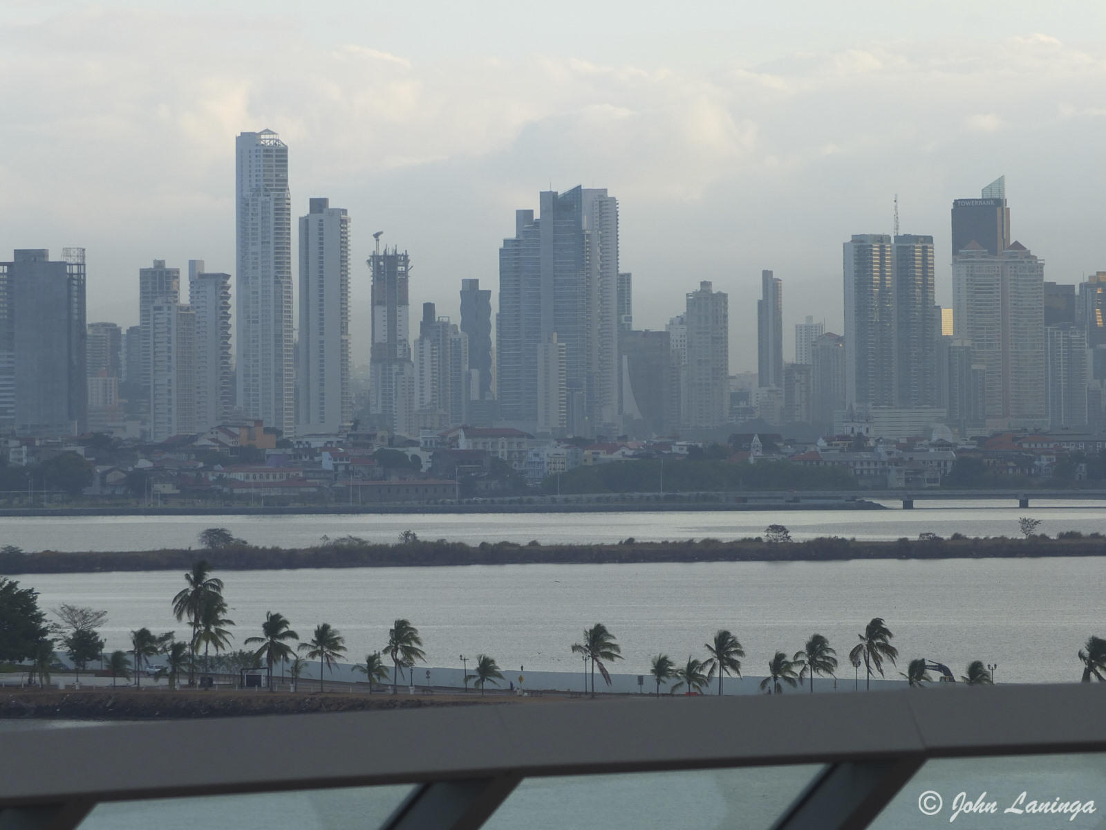
Panama City is a major city
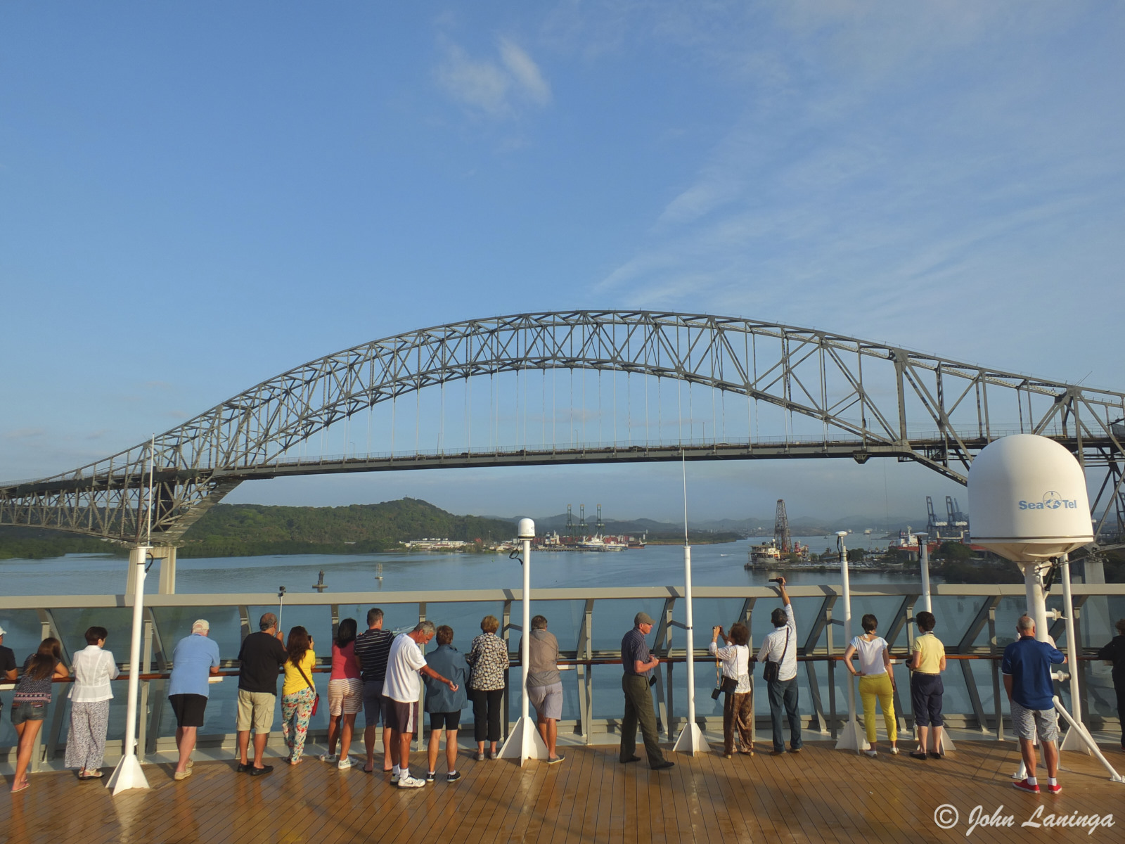
The Pan American bridge
A good view of the Pacific side new locks
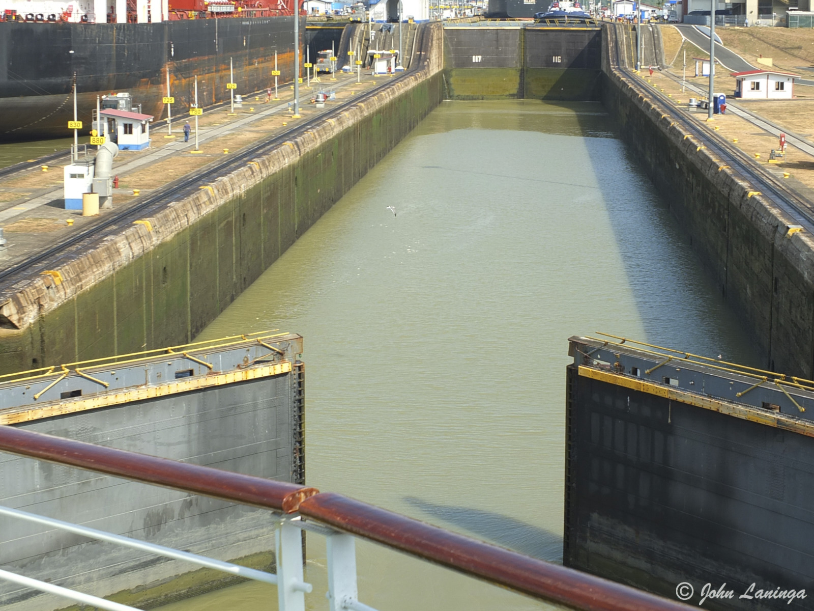
Entering the locks
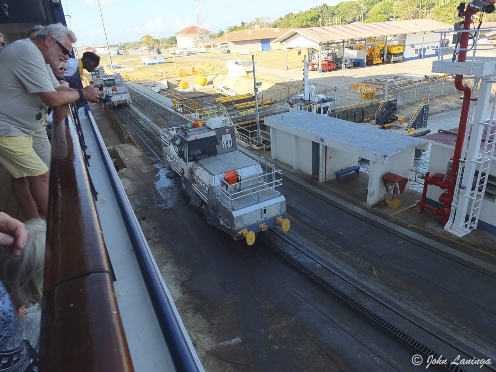
Hooking up the mules
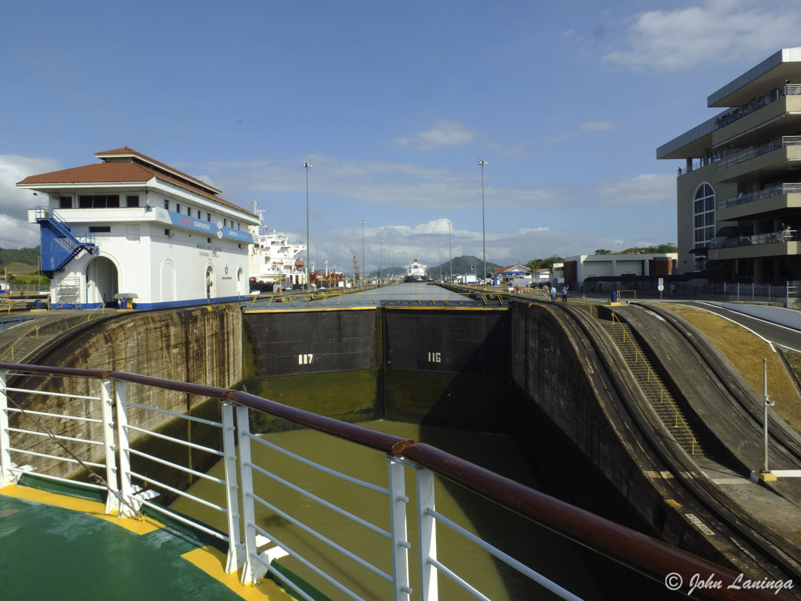
Almost all the way in
Guiding us through the locks
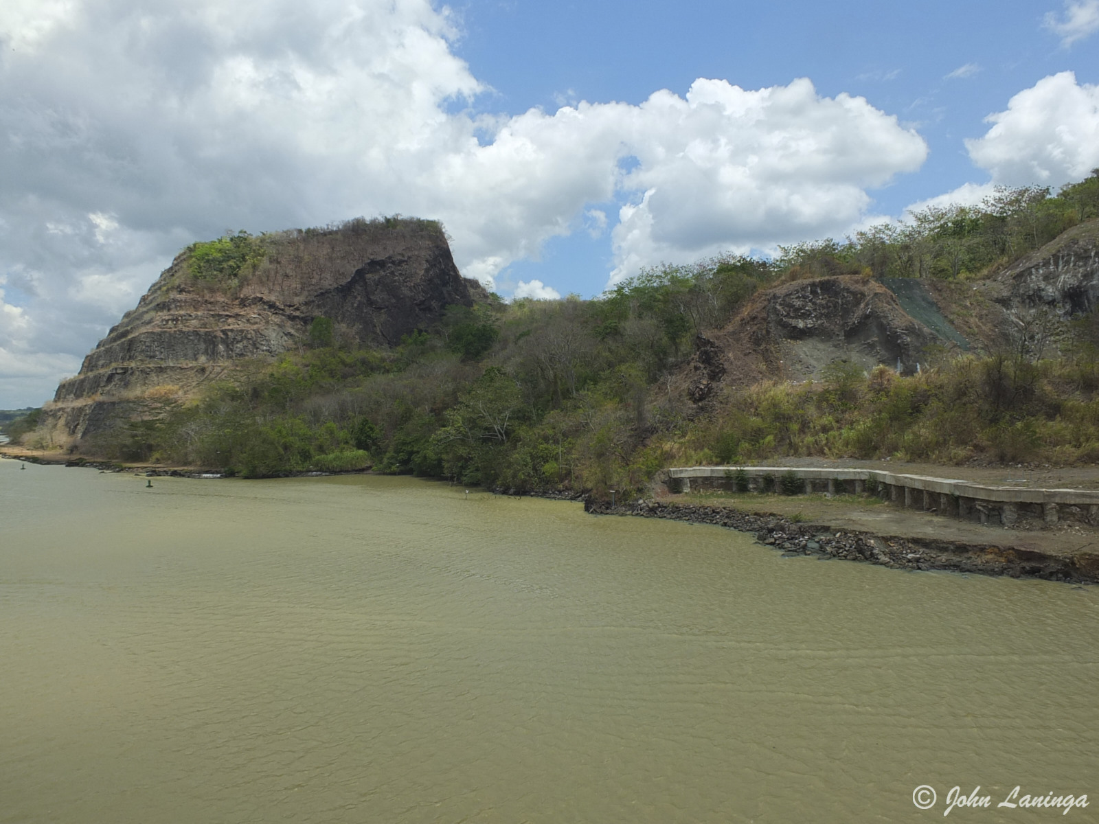
Culebra Cut, where thousands died
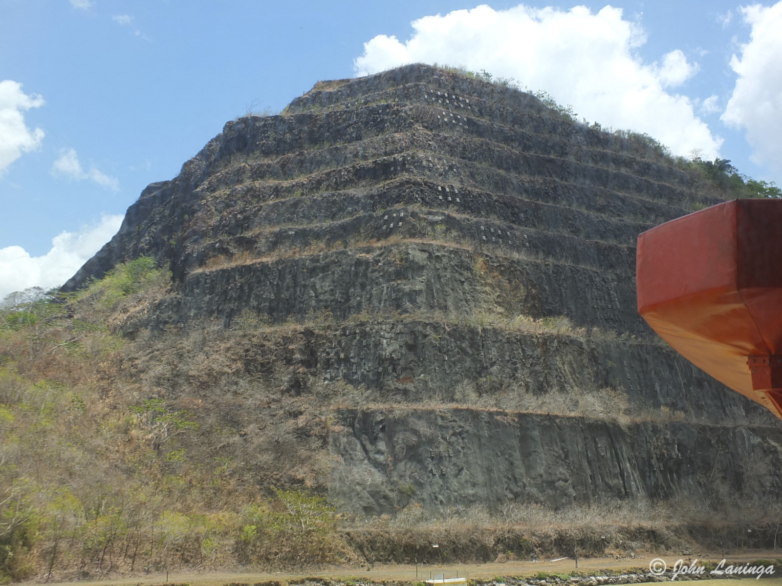
“Gold Hill” – workers were told they could keep any gold they find. Of course, there is no gold in volcanic rock….
Approaching the Gatun locks
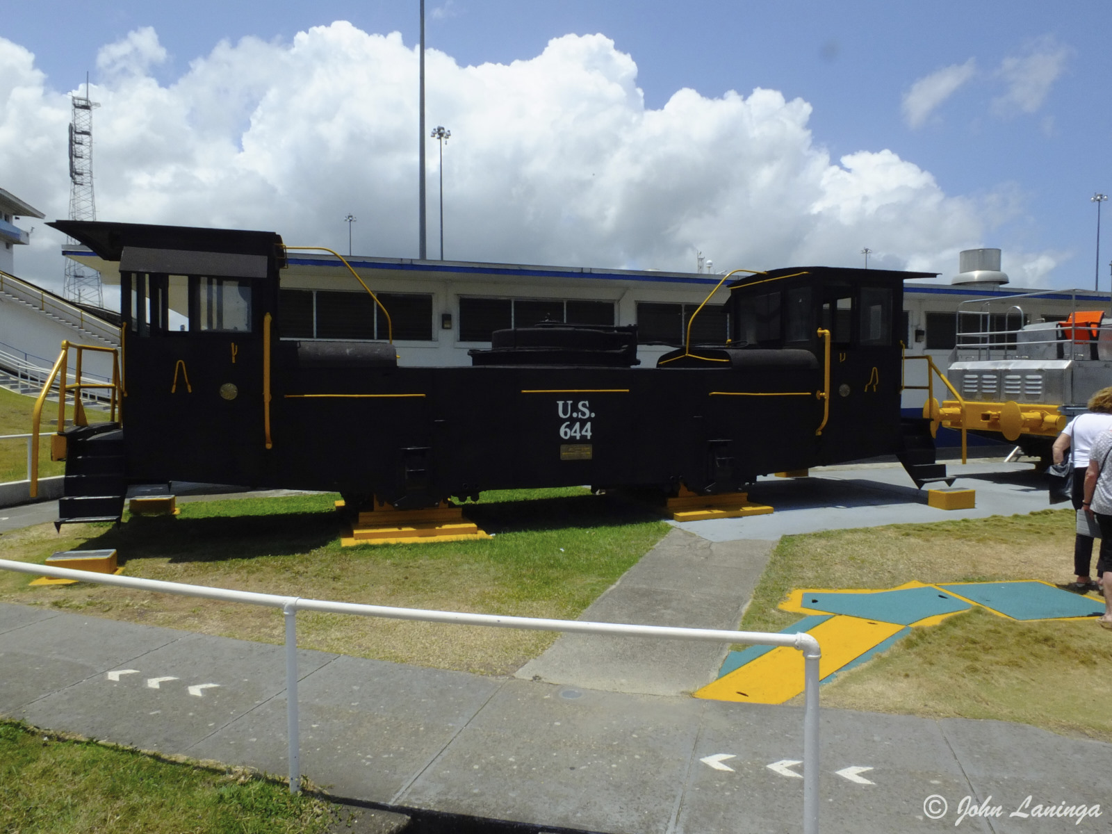
Original mule
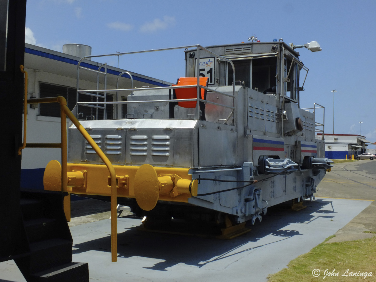
Second generation mule
Look! The Caribbean Ocean!
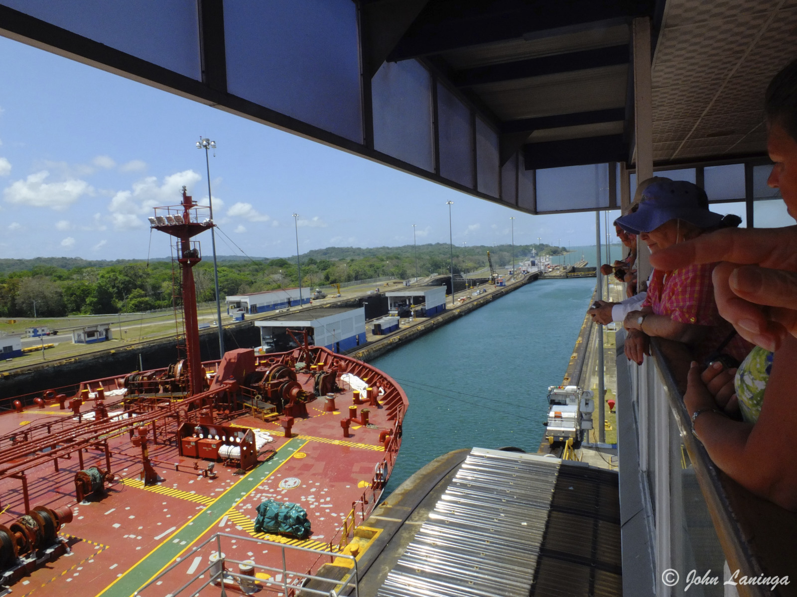
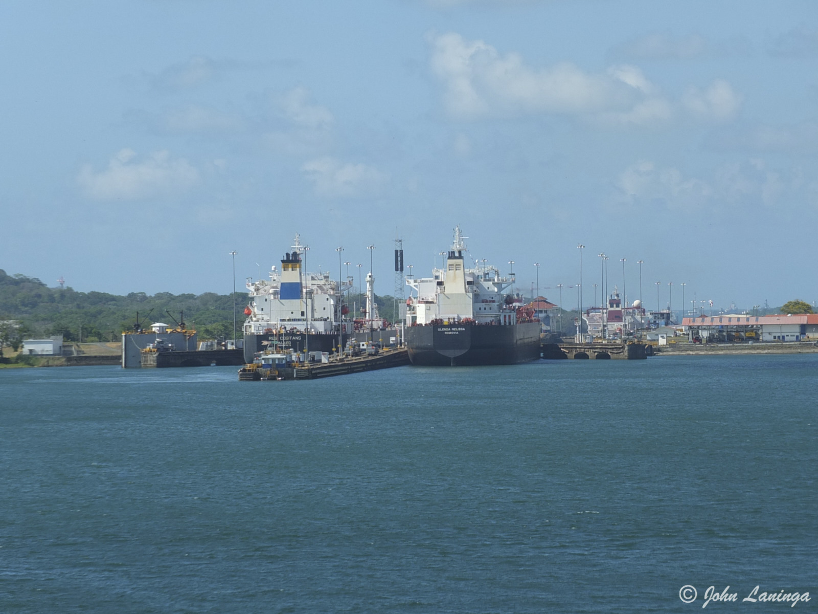
Watching a huge tanker go through
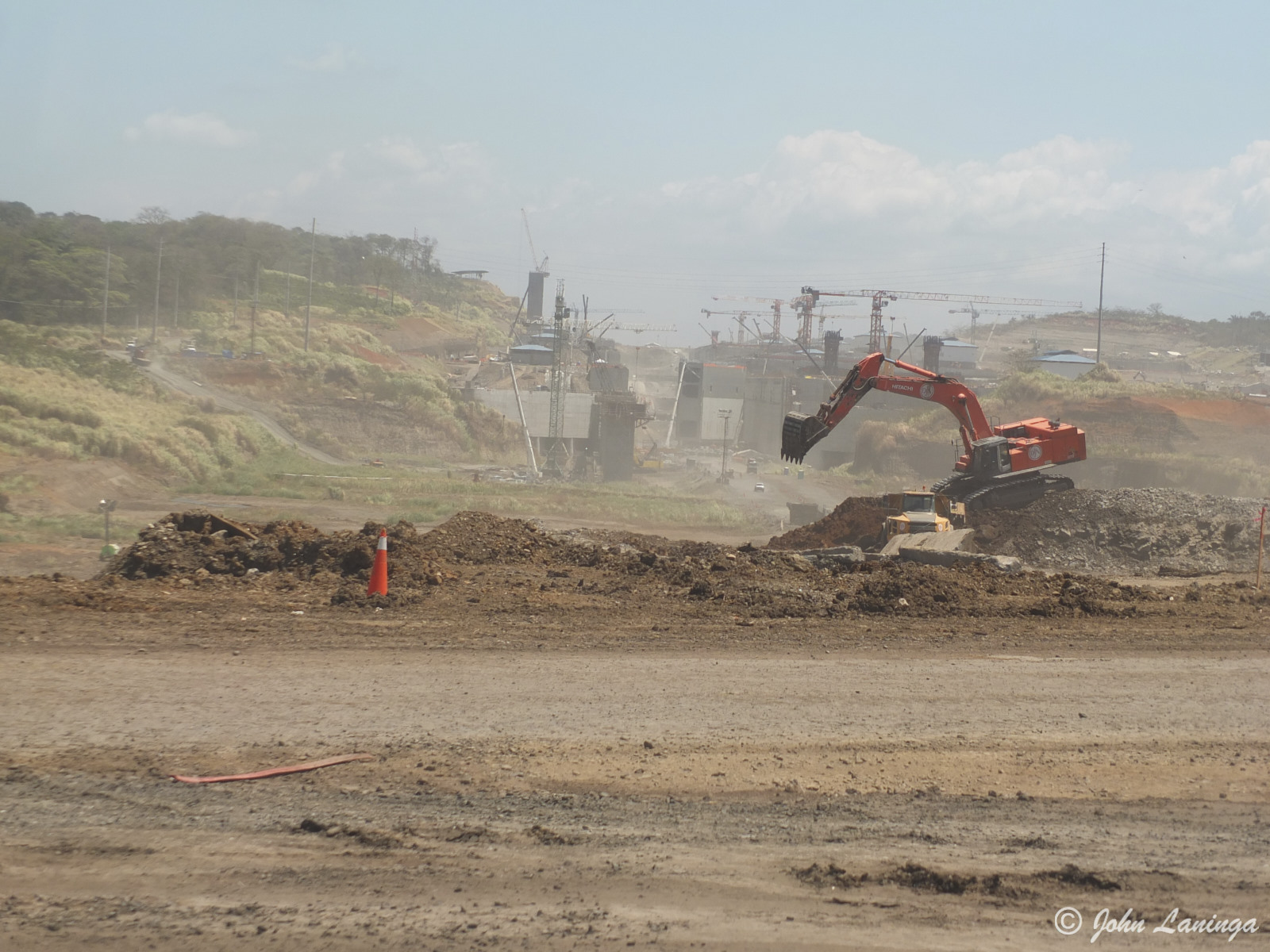
Working on the new locks
Cruise, Week Three
Our second leg of the cruise started in the port city of Valparaiso. Unfortunately, serious fires the night before our arrival meant so much smoke in the air we didn’t even go off the ship for our customary walk. So, we sat around in the the terminal until we could re-board the ship.
After 2 sea days, we arrived at Arica, Chile. In the rain… the first rain for this city in FORTY YEARS! Locals were very excited by the rain. We took a cruise to view the geoglyphs, enormous figures on the hill side. Based on their location and orientation, it is presumed these were navigational aids to find your way out of the desert to the sea.
A visit to the local museum introduced us to the Chinchorro mummies. These 7,000 year old mummies pre-date Egyptian ones by some 2,000 years, and show an entirely different civilization existed here. They used a most unique mummification technique. Careful preservation is necessary as the humidity, even as low as it is, is increasing which affects the mummy materials.
Although arid, this area has excellent soil, so with irrigation it is a big producer of many types of fruit and vegetables. Because there is only one season here all year, there are no seasonal products… everything grows all year. Especially olives, a major crop.
Our next stop was supposed to be Lima, but a problem with the completion of dock construction diverted us to Pisco, Peru. There is really nothing to do or see here unless you take expensive excursions, so we stayed on board until we departed for Manta, Ecuador
Manta proved to be quite interesting. This is the area where the Panama Hat originated, and it still is one of the mainstay industries in this area. The ladies who weave the hats have a very unique way of working!
The St. Mark’s church is particularly interesting… it was designed and pre-fabbed by Gustav Eiffel (before the Eiffel tower) and shipped with two other buildings to Arica. These were to replace originals destroyed by an earthquake. All the metal pieces fit together and require a key to assemble/disassemble them. When Peru lost the territory in a war they took the “church key” with them.
As usual, click on the Flickr link (below right) and then Albums to see all photo albums. Our next stop: the Panama Canal.

Smoke over Valparaiso

Some of the not so desirable portions of the city

Enormous geoglyphs in the distant mountains

Ancient Chnichorro mummies

Church, designed by Gustav Eiffel
Inside St. Mark’s church, showing Eiffel’s traditional metalwork

A very busy street in Manta

Local entertinment

Manta is definitely a port city

Making Panama hats
.
